
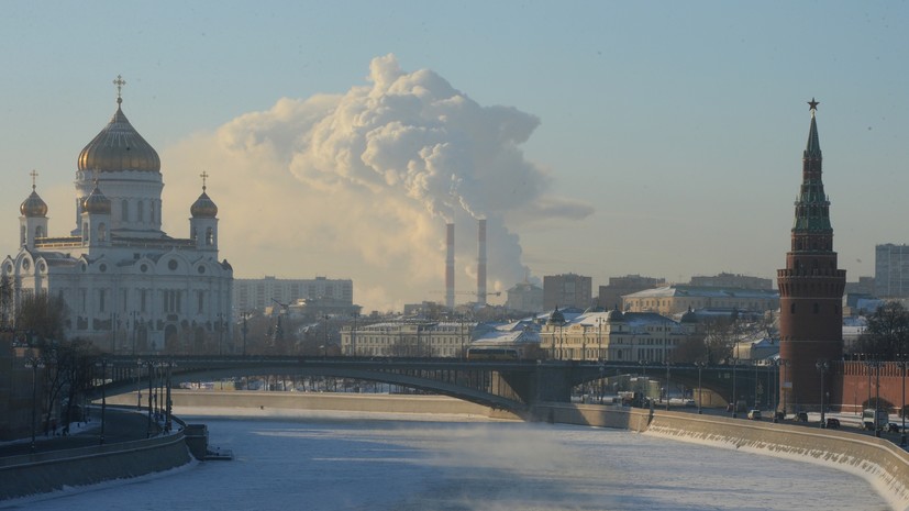
The upcoming Saturday in Moscow may be the coldest day of this winter. This was reported by RT chief specialist of the Moscow Weather Bureau Tatyana Pozdnyakova.
“The weather will be determined by the area of high atmospheric pressure, the wind will begin to subside. On Saturday night in Moscow, the temperature can drop to -11 ...- 13 ° C in the center, on the outskirts - to -16 ° C. In the suburbs, especially in lower elevations, -16 ...- 18 ° C is expected. The daily temperature tomorrow is around -7 ° C, in the region of -5 ...- 10 ° C, ”said Pozdnyakova.
Moreover, according to her, such low temperature values in the metropolitan area will not last long.
“Starting from Sunday, warmer air will begin to come to us. This will affect the temperature regime, the night will become much warmer. In Moscow, -5 ...- 7 ° С is expected, in the region up to -10 ° С. Sunday’s daytime temperature is -1 ...- 3 ° С, in the region up to -1 ...- 6 ° С, ”the weather forecaster explained.
She added that warming will continue in the following days. So, by the middle of the week (February 10-16), the thermometer columns will again be in the zero area.
“And we will enter the next time of the thaw,” concluded Pozdnyakova.
In turn, the supervisor of the Hydrometeorological Center of Russia, Roman Vilfand, called the weather in Moscow this weekend truly winter. He noted that the temperature regime will approach the usual values for this time of year.
“But on Sunday we return to the already familiar thaws. In the first half of the day the temperature will be negative -3 ...- 5 ° С, and by the evening the temperature will rise to -0 ...- 2 ° С, ”he stated in an interview with RT.
According to the data of the Hydrometeorological Center of Russia, on Friday, February 7, in Moscow the air cooled to -7 ...- 9 ° С. Precipitation in the form of snow fell in the city, and sleet formed in places. In this regard, the Center for Traffic Management appealed to motorists.
“On the Beaufort scale, with tree winds of 12-17 m / s, tree trunks and billboards swing. In the capital, this will be all day (until about 21 hours). Plus ice and blizzard, and as a result - ideal conditions for an accident. Today, more than ever, attention, accuracy, distance and adequate speed are needed, ”the message says.
On the Beaufort scale with a wind of 12-17 m / s, tree trunks and billboards swing. In the capital, this will be the whole day (≈ up to 21 hours). Plus ice and blizzard, and as a result - ideal conditions for an accident. Today, more than ever, attention, accuracy, distance and adequate speed are needed. pic.twitter.com/TTHYsyktwL
- DPC (@gucodd) February 7, 2020However, the past January in Moscow set a record, becoming the darkest in the last 20 years. It is reported by Meteonews. According to the portal, residents of the capital could observe the Sun in only 11 hours for the entire first month of 2020, at a rate of 33 hours. It is worth noting that a similar situation was in 2004, when the Sun was visible only 13 hours for the whole of January.
"Temperature swing"
The supervisor of the Hydrometeorological Center of Russia, Roman Vilfand, also spoke about weather changes occurring in other regions of the country. He noted that until recently, the temperature in the European territory of the Russian Federation was abnormally high, deviations from the norm ranged from 9 to 11 degrees.
“Now in the Crimea, in the Caucasus, in the Stavropol Territory, the temperature is from +0 ...- 4 ° С. Moreover, in the east, in the Omsk, Tomsk, Novosibirsk, Kemerovo regions and even in Krasnoyarsk, the temperature is about 0 ° C. In Tyumen yesterday there was a temperature of +1.5 ° C - a record value. It turns out that in the south of the European territory of Russia 1-2 degrees tomorrow and the day after tomorrow will be colder than in the regions of southwestern Siberia. This is completely unusual, ”he explained.
We add that the administration of Sochi on Friday, February 7, announced an emergency warning until the end of the day due to the fact that in the foothills and low mountains, "strong sticking of wet snow to wires and trees" is expected, as well as a rise in the water level in the rivers of the Black Sea coast .
At the same time, it was reported on the Metevesti website that residents of southern Russia should prepare "for an Arctic invasion." At the weekend, it is expected that in most of the region, even during daylight hours, the thermometer bars will not rise above zero.
In addition, meteorologists predict "temperature swings" in the regions located on the Russian Plain.
“Fields of frontal clouds will break through to the spurs of the Caucasus, followed by colder air. Rains will turn into snow even in the Crimea and the Kuban. The most intense precipitation is predicted in the south-west of the region - over 20 mm. And snow clouds from the lower Volga and Don will move to the Urals. Together with bad weather, warming will come there, ”the message says.