
A transformative continental fault that forms a long series of geomorphological depressions, which arose as a result of the division between the continents of Asia and Africa since the beginning of the Miocene, and extends from the southeastern Anatolian plateau in the north to the northern Red Sea in the south.
The Dead Sea fault is an area where earthquakes are active and has a record of earthquakes of varying intensity since prehistoric times, some of which were devastating.
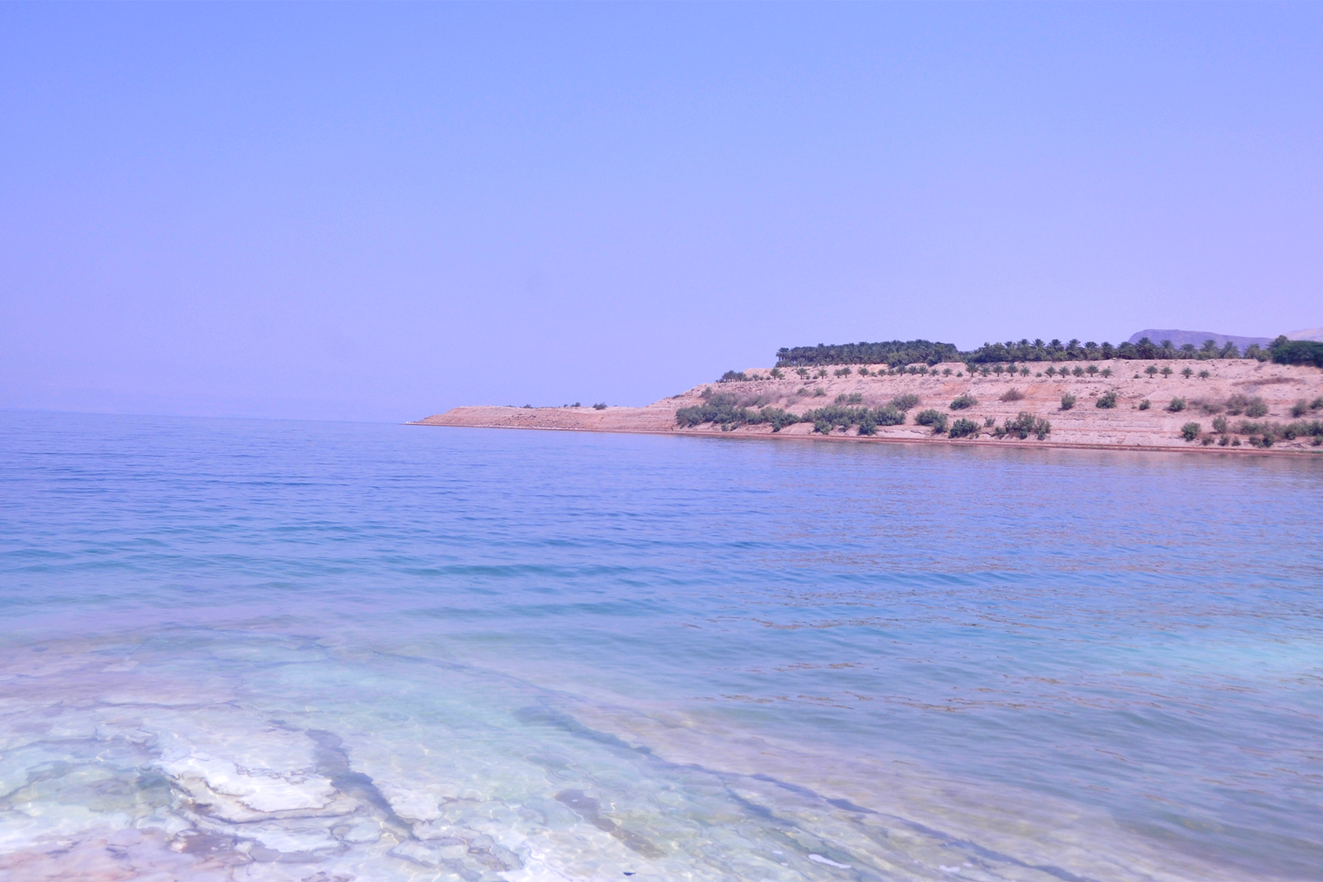
Location and geography
The Dead Sea Rift is a transformational continental fault that forms a long series of geomorphological depressions (terrain depressions) estimated to be about 1100,<> kilometers long, extending from the southeastern Anatolian Plateau in the north to the northern Red Sea in the south.
The rift starts from the Taurus Mountains east of the city of Antakya in southern Turkey, passing through Syria and Lebanon, then separating Palestine and Jordan towards the Red Sea.
It separates the Arabian (Eastern) Plate, which includes Syria, Jordan, and the Arabian Peninsula, and the African (Western) Plate, which includes Palestine, the Sinai Peninsula, and Africa.
It is a unique land-sea transition along its axis, and a large part of it is covered by water, the southern part of which consists of the Gulf of Eilat and represents a marine environment, while other parts of it cover two lakes: the highly saline Dead Sea and the freshwater Sea of Galilee.
Nomenclature
The fault is known as the "Dead Sea Fault" or "Dead Sea Fault", as well as several names such as the "Jordanian Rift", "Wadi Araba Fault", and the "Metamorphic Dead Sea Fault", while some prefer to call it the "Levant Fault System", to express the entire group of faults forming the main fault.
Origins & Departments
The current geography of the Dead Sea rift arose as a result of the processes of continental division between Asia and Africa since the beginning of the Miocene period, and this separation from the African plate, which is still effective, is vertical displacement processes that caused a subsidence in the ground and raising the edges to form heights on the sides, and the rift is affected by a continuous horizontal sliding displacement.
The fault consists of a series of topographic faults and faults that are divided into 3 main parts:
- Southern Section: It starts from the Gulf of Eilat passing through Wadi Araba, the Dead Sea and the Jordan Valley to Lake Tiberias and then the Houla Basin.
- The middle section "Lebanese Restriction Curve": includes the Yamouna Rift, the Rum Rift, and the Rashaya and Sarghaya Rifts.
- Northern Section: It includes the Masyaf Rift, the Al-Ghab Rift and the Latakia Rift Area, and ends with the Karso Rift.
Tectonic motion and faults
The Dead Sea fault with its inland basins and figrating cliffs is an example of the early stages of the development of continental disintegration and emerging continental edges.
Researchers believe that horizontal movement along the main fault was formed by the détente tectonic movement of the breadth of the Red Sea floor in the south, accompanied by a lateral displacement estimated at 107 kilometers over millions of years.
This movement occurred in stages as a result of the slide of the Arabian plate in a north-northeast direction associated with the complex collisional movement of the Anatolian plate northward.
The transverse faults were formed as a result of the compression of the horizontal movement that takes an east-west direction, and such faults appear in Wadi Khanziria in the Fifa Valley and the north and south of the tongue formation in the Haditha Valley, and represent the main eastern valleys that flow into the Dead Sea and follow the transverse faults from the east and west.
The rift forms a tectonically expanding basin that is successively filled with sediment coming with flooding through the eastern and western valley ranges, and this process has been going on for tens of millions of years, and the continuous erosion and erosion processes carve the rocks and mountains of cities and villages, which are transported with torrents to settle in the body of the eclipse.
The fault is also affected by its central location at the confluence of 3 tectonic plates: African, Arab and Eurasian-Anatolian secondary plate, where these plates collide to form the tectonic structures of the region, including the formation of the secondary Sinai-Palestine plate.
This makes the region vulnerable to various sources of tectonic activity spread along the rift from the Gulf of Aqaba south to the northern boundary of the Arabian Plate and the Anatolian Secondary Plate.
Seismic activity
The Dead Sea fault is a seismic activity, as the sliding movement of the Arab plate moves away from the African plate with a displacement movement that is relatively slow, estimated at a few millimeters per year, but it collects as energy that prevents the friction of rock masses in the depths, so the movement occurs suddenly and the giant rock masses break, producing seismic energy commensurate with its strength with the depth of the epicenter of the earthquake and the amount of energy released and displacement.
As well as the collisional movement of the Arab plate with the "Eurasian-Anatolia" plate in the north, which produces energy that is also liberated in the form of earthquakes.
As a result of this tectonic situation, the region has a record of earthquakes of varying intensity since prehistoric times, and has been affected by a number of devastating earthquakes, mainly related to the movement of the Arabian plate towards the north, and these earthquakes caused great loss of life and property.
The fault zone is still seismically active and seismic recordings of the Jordan Seismological Observatory indicate that the Gulf of Aqaba is the largest source of tectonic activity in the fault zone, and this was confirmed after the 1995 Gulf of Aqaba earthquake with a magnitude of 7.3 on the Richter scale.
Based on the observatory's accumulated seismic records since 1996, it was found that the area is in a calm state despite some medium-intensity earthquakes, and indicates a northward transition of seismic activity along the Dead Sea Metamorphic Rift while remaining within the average rate of strength.
The most famous earthquakes in the fault zone
Among the strongest earthquakes caused by the movement of the fault are:
- Jordan earthquake in 363 AD: A devastating earthquake whose effects extended from the Galilee region in the north to the Gulf of Aqaba in the south, and caused the destruction of most of the city of Petra, in addition to significant damage to a number of cities such as Jerash and um Qais in northern Jordan and many Palestinian cities.
- Beirut earthquake in 551 AD: It occurred near the city of Beirut and the damage extended from Tripoli in northern Lebanon to the Jordan Valley and the city of Petra, in addition to the formation of tsunamis over large areas of the Lebanese coast from Tripoli to the city of Tyre.
- Jordan Valley earthquake 749 m: A catastrophic earthquake struck the Jordan Valley region, destroying the entire cities of Tiberias, Beisan, Jericho, Bella "Tabaqat Fahal", Jerash and Amman.
- Jordan Valley earthquake 1033 AD: Successive violent and strong earthquakes centered in the Jordan Valley and felt by people from southern Turkey to northern Egypt, led to the complete destruction of the cities of Tiberias and Jericho and the demolition of large parts of the Al-Aqsa Mosque and the walls of Jerusalem.
- Aqaba earthquake in 1068 AD: A devastating and severe earthquake centered in the Gulf of Aqaba and its effects extended to Palestine, Syria, Cairo and the Arabian Peninsula.
- Syria earthquake 1202 m: This earthquake occurred in southwestern Syria, and it is the strongest earthquake ever in the region, as it was felt by people from Iran in the east to Andalusia in the west.
- Baalbek and Baysan earthquake 1759 AD: A violent earthquake that included a large part of the Levant, and was classified as the second largest earthquake in the region after the 1202 earthquake.
Earthquake prediction in the fault zone
The conditions of earthquake formation are very complex, and many of them take place in the depths of the deep earth and are difficult to monitor and track, and it is difficult to analyze and give a clear picture of them to issue an alarm in time, if scientists predict the place, they cannot predict the time and magnitude of the earthquake.
Statistical studies determine the probability of occurrence, by identifying seismically active areas and determining a temporal and spatial range as a matter of probability, according to the historical record of earthquakes in the area.
The Dead Sea fault is of a moderate seismic character and is classified from moderate to light, which of course does not prevent it from being exposed to active tremors, but the movement of the tectonic plates in the fault is divergent rather than impactful movement in general, which makes them less vulnerable to earthquake hazards.
According to experts, the fault needs a discharge of potential energy due to tectonic motion, and weak earthquakes that occur frequently along the fault help prevent a devastating earthquake, because light tremors discharge this energy, but this does not prevent an earthquake of unexpectedly high intensity.