
China News Service, December 15th. According to the website of the Central Meteorological Observatory, it is expected that in the next three days, there will be more cloudy and light rain (snow) weather in the eastern part of Southwest China, Jiangnan, and southern China. Snow or sleet, freezing rain in central Guizhou and western Hunan, and light rain in other areas.
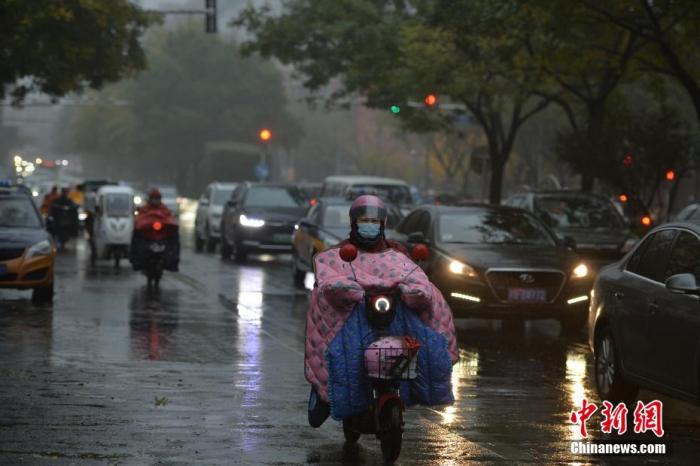
Data map: Citizens travel in the rain.
Photo by Tian Yuhao, China News Agency reporter
Yesterday, there was rain and snow in Jiangxi, Zhejiang and other places, and the temperature in southern China dropped significantly
Yesterday, there were snowfall, sleet or rain-to-snow in parts of central and southern Zhejiang, northwestern Jiangxi, and northeastern Hunan, with precipitation ranging from 3 to 15 mm; freezing rain occurred in western and southeastern Guizhou, and central Hunan.
At 5 o'clock today compared to 5 o'clock yesterday, affected by strong cold air, 4~8℃ cooling occurred in the central and eastern part of Guizhou, southwestern Jiangxi and southern China, and some areas in southern Guangxi, southern Guangdong and other places dropped by 10~12℃. The temperature this morning is 0℃. The line is located from southern Guizhou to southern Jiangsu and Anhui; some of the above areas are accompanied by gusts of magnitude 4 to 5 and local gusts of magnitude 6 to 8.
Most of the south is overcast and rainy
It is expected that in the next three days, there will be more cloudy and light rain (snow) weather in the east of Southwest China, Jiangnan, and South China. Among them, there will be light to moderate snow or sleet in the mountainous areas of northern Guizhou, western Jiangnan, and freezing rain in central Guizhou and western Hunan. Other areas are dominated by light rain; the temperature in the above areas is lower than usual, with less sunshine and obvious coldness.
7-8 winds in the southeast and southern seas
It is expected that during the daytime on the 15th, there will be northeast winds of magnitude 6 to 7 and gust 8 in the southern waters of the East China Sea, the Taiwan Strait, the east of Taiwan, the Bashi Strait, the Beibu Gulf, the northern and central waters of the South China Sea, and parts of the southwestern South China Sea. The winds of the Taiwan Strait, the northeastern and central-eastern part of the South China Sea, and the Bashi Strait can reach force 8 and gust 9 winds.
Specific forecast for the next three days
From 08:00 on December 15 to 08:00 on the 16th, there was light to moderate snow or sleet in parts of the southeastern part of Northwest China, north-central Guizhou, southwestern Jiangnan, western Xinjiang, and eastern Tibet.
There was light rain in parts of the central and eastern Jiangnan, Sichuan Basin, eastern Yunnan, and most of southern China, and local moderate rain (10-20 mm).
In addition, the southern waters of the East China Sea, the Taiwan Strait, the east of Taiwan, the Bashi Strait, and the northeastern South China Sea will have strong winds of magnitude 7-8 and gusts of magnitude 9-10 (see Figure 1).
Figure 1 National precipitation forecast map (from 08:00 on December 15 to 08:00 on December 15)
From 08:00 on December 16th to 08:00 on the 17th, there was light snow or sleet in parts of the eastern part of the Qinghai-Tibet Plateau, the southeastern part of the northwestern region, and the north-central part of Guizhou, among which there was moderate snow in parts of eastern Tibet.
There was light rain in parts of the Sichuan Basin, southern Guizhou, eastern Yunnan, most of Jiangnan, most of southern China, and Taiwan Island, among which there was moderate rain in eastern Taiwan Island.
There are 4 to 5 winds in parts of northeastern Heilongjiang (see Figure 2).
Figure 2 National precipitation forecast map (from 08:00 on December 16 to 08:00 on December 17)
From 08:00 on December 17 to 08:00 on December 18, there was light snow or sleet in parts of the eastern Qinghai-Tibet Plateau, the southeastern part of the northwestern region, the northern part of the Western Sichuan Plateau, the central and northern part of Guizhou, and Chongqing. Among them, eastern Tibet, southern Gansu, and western Sichuan There is moderate to heavy snow in parts of the northern plateau and other places.
There was light rain in parts of the Sichuan Basin, most of Jiangnan, southern Guizhou, most of Guangxi, and most of Taiwan Island.
In some areas of northeastern Inner Mongolia, western Heilongjiang and other places, there are 4-6 winds (see Figure 3).
Figure 3 National precipitation forecast map (from 08:00 on December 17 to 08:00 on December 18)