
Reunion Island threatened by intense tropical cyclone
The French island located in the Indian Ocean went on Saturday 13 January to an orange cyclone alert, synonymous with "danger within 24 hours", due to the approach of tropical storm Belal which could turn into a "very dangerous cyclone".
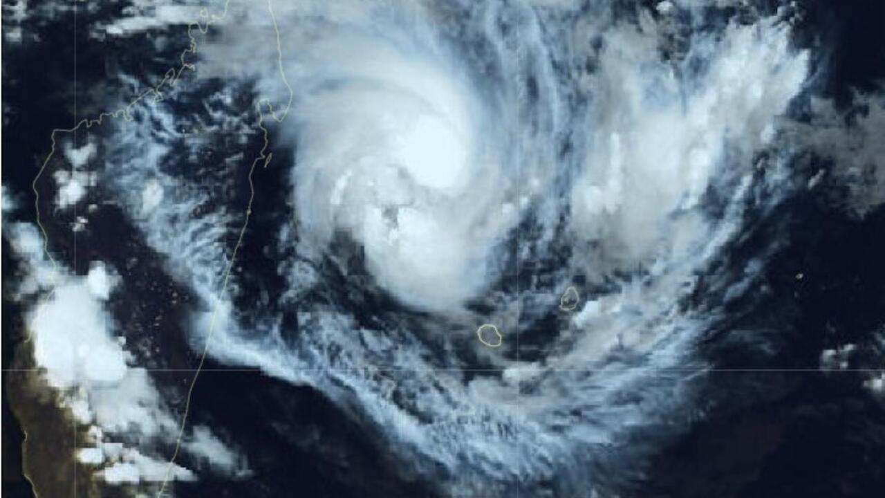
Bilal is expected to pass as close as possible to Reunion Island between the end of the night from Sunday to Monday and the day on Monday. © Weather France
By: RFI Follow
Advertising
Read More
«
We have to take seriously, even very seriously, what is happening ", warned the prefect of Reunion Island, Jérôme Filippini, during a press conference. "You have to stock up on water and food, be prepared to be self-sufficient for a few hours or a few days, have your first aid kit. We have to ask ourselves now (the question) where you will be safe from Sunday evening," insisted the prefect of this French department and region of some 870,000 inhabitants, announcing the activation of the orange cyclone alert.
The orange alert is the second level of the cyclone warning system, which has four levels. It means that "an event of a cyclonic nature (...) evolves in the area and represents a danger for Reunion within 24 hours, "according to Météo France.
Named Belal, the storm is intensifying. The system is expected to pass as close as possible to Reunion Island between the end of the night from Sunday to Monday and the day on Monday. According to current forecasts, the eye of the cyclone could pass about 100 km inland, between Reunion Island and Mauritius. It would then be "at the stage of a cyclone, or even an intense cyclone as close as possible to Reunion Island. We expect significant impacts due to winds, rain and swell," said Céline Jauffret, interregional director of Météo France.
Météo France forecasts gusts of more than 150 km / h on the heights of the island. But in the event of a direct impact on the island, winds could exceed 220 to 250 km/h. A swell exceeding six metres and heavy rainfall are also expected.
Reunion Island has not been hit by an intense cyclone for ten years and the passage of Bejisa in the first days of 2014. Asked about the triggering of the red alert, synonymous with imminent danger, the prefect replied that this passage was "quite likely", even if "it is much too early" to give the day and time of its activation.
(
With AFP)
NewsletterGet all the latest international news straight to your inbox
Subscribe now
Follow all the international news by downloading the RFI app
Share:
Read on the same topics:
- France
- Climate