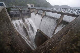
"It is clear what happened: a cyclone stationed on the border between Germany, France and Belgium and there it discharged all its energy. Now it is moving towards the Adriatic". Antonio Navarra, climatologist of the University of Bologna and president of the Euro-Mediterranean Center Foundation on Climate Change, is interviewed by Repubblica and thus comments on the recent floods in central Europe. Professor Navarra, are events like this certainly attributable to the climate emergency? "It is very probable, but to be scientifically correct we cannot speak of certainty. These are phenomena that have completely different time scales and it is difficult to explain a punctual event with a process that instead extends over centuries.It would be like wanting to create a cause-and-effect relationship between the fact that I stumbled on a street in the capital and the collapse of the Roman Empire. Probably the link is there but it is difficult to scientifically prove it. Some colleagues are trying to demonstrate the link between global warming and individual extreme weather events, but in the end we can only talk about it in statistical terms. "But the 'extreme' phenomena are increasing:" This is beyond doubt. There is a clear correlation between the increased concentration of carbon dioxide in the atmosphere and the frequency and intensity of floods, heat waves and periods of drought. In the specific case of precipitation, we are witnessing a gradual shift towards the north of the two bands that cross Europe. One passes in the central area of the continent,the other crosses the Mediterranean. The latter is migrating towards higher latitudes: in a few years with us there will be less and less rain that will pour right where there was yesterday's flood. Our projections show a decrease in rainfall of between 15 and 20% for the Mediterranean area ".
Share
July 16, 2021
"It is clear what happened: a cyclone stationed on the border between Germany, France and Belgium and there it discharged all its energy. Now it is moving towards the Adriatic". Antonio Navarra, climatologist of the University of Bologna and president of the Euro-Mediterranean Center Foundation on Climate Change, is interviewed by Repubblica and thus comments on the recent floods in central Europe. Professor Navarra, are events like this certainly attributable to the climate emergency? "It is very probable, but to be scientifically correct we cannot speak of certainty. These are phenomena that have completely different time scales and it is difficult to explain a punctual event with a process that instead extends over centuries.It would be like wanting to create a cause-and-effect relationship between the fact that I stumbled on a street in the capital and the collapse of the Roman Empire. Probably the link is there but it is difficult to scientifically prove it. Some colleagues are trying to demonstrate the link between global warming and single extreme weather events, but in the end we can only talk about it in statistical terms ".
But the 'extreme' phenomena are increasing: "This is beyond doubt. There is a clear correlation between the increase in the concentration of carbon dioxide in the atmosphere and the frequency and intensity of floods, heat waves and periods In the specific case of rainfall we are witnessing a gradual northward shift of the two belts that cross Europe. One passes through the central area of the continent, the other crosses the Mediterranean. The latter is migrating towards higher latitudes: between a few years with us there will be less and less rain that will pour right where there was yesterday's flood. Our projections give for the Mediterranean area a drop in rainfall of between 15 and 20% ".