
Chinanews.com, December 28th. Comprehensive news. On the morning of the 28th, the Central Meteorological Observatory upgraded and issued a cold wave orange warning: It is expected that from 28th to 31st, most parts of central and eastern China will start the "quick freezing" mode, ushering in a cold wave weather process.
This is also the highest level of cold wave warning issued by the Central Meteorological Observatory since November 2016.
"Overlord" cold wave! Gale cooling + rain and snow weather one-time "delivery"
The latest weather monitoring data show that in the past day, a small advance of cold air has brought cooling to northern Xinjiang, northern Inner Mongolia and northeastern regions.
Today, the cold wave will formally enter the northern region. In the next 24 hours, strong cooling and windy weather will occur in most of Inner Mongolia, Liaoning, the eastern part of Northwest China, and northern China. The temperature drop in some of the above-mentioned areas can reach 10~14℃; starting tomorrow, the cold wave The forces are heading south, Huanghuai, Jianghuai, Jianghan, Jiangnan, South China and other places will experience "roller coaster-style" cooling, local cooling rates of more than 16 ℃, accompanied by 4-6, gusts of 7-9 northerly.
Data map: The cold wave is coming, and the south is snowing.
Photo by China News Agency reporter Zhang Chang
In addition, today and tomorrow (28th to 29th), there will be significant rain and snow in the eastern part of Northwest China, southern North China, Huanghuai, Jianghuai, Jianghan and other places, including southern Shaanxi, eastern Shandong, western Henan, northern Hubei, and central Anhui. There were moderate to heavy snow and local blizzards in parts of southern, central and northern Jiangsu and other places.
Meteorological experts reminded that due to the strong cooling, the temperature in many parts of the central and eastern regions will continue to fall, reaching the lowest point since the beginning of winter this year.
Special attention should be paid to the temperature rise in Jiangnan and South China in the past two days. The temperature drop during the day will be particularly noticeable when the cold wave comes. The public is requested to be vigilant, take measures to prevent cold and warm, and beware of colds.
In addition, Shandong, Henan, Jiangsu, Anhui, Hubei and other places have high intensity of rain and snow, and some areas will also experience the process of rain and snow conversion. It is necessary to prevent adverse effects on travel traffic such as severe weather and road snow and icing.
Hu Xiao, chief meteorological analyst of China Weather.com, said that if the cold wave weather process is likened to "express delivery", first it is the "delivery place". From the perspective of weather principles, this cold wave is caused by high pressure in Siberia and high blocking pressure. Formed in cooperation with the polar vortex, powerful cold air accumulates in Siberia and then erupts.
The delivery process is no longer multi-share "shipping in batches", but one-time delivery, "direct mail to home."
Therefore, from the point of view of characteristics, "quick freezing" is the biggest feature of this cold wave weather process. The cold air moves quickly and the wind chill effect is obvious. At the same time, there are obvious rain and snow weather in some areas. These will be "packaged" well, once In place.
Hu Xiao said that in recent years, what has impressed everyone is the "Overlord" cold wave in late January 2016.
However, compared with the upcoming cold wave this year, the absolute temperature during the cold wave in late January 2016 was lower because the overall temperature level in my country was already lower in late January.
However, the cooling rate during this cold wave is even faster, and in some areas, the cooling is “cliff-style”.
For example, in the middle and lower reaches of the Yangtze River, the general temperature drop was around 15°C within 48 hours of the cold wave, which was more intense than the cold wave in January 2016, and the cold felt by the public was more obvious. From this perspective In other words, this year's "New Year's Eve" cold wave will be as cold as the "Overlord" cold wave in late January 2016.
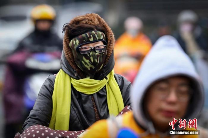
Data map: People traveling "fully armed".
Photo by China News Agency reporter Yang Bo
Beijing opens "quick freezing" mode, maximum temperature drops below freezing
It is expected that today, affected by the cold wave, Beijing will usher in a significant drop in temperature. The highest temperature during the day will be around minus 1°C; there will be obvious northerly winds from midnight to 30th during the day, and the wind chill will have a significant effect. We remind citizens to take precautions.
According to the latest forecast issued by the Beijing Meteorological Observatory at 6 o'clock this morning, Beijing will be cloudy during the day (light snow or sporadic snow in the mountainous area), with northerly winds of 2 and 3, and the maximum temperature of minus 1℃; at night, it will turn cloudy. North wind level 2 turns to level 4 and 5 (gust level 7), and the minimum temperature is minus 8℃.
Local blizzard gusts in Shandong can reach levels 7 to 8
Today, with the arrival of cold air, Shandong will encounter cold wave weather successively, with rain, snow, and strong winds.
Specifically, from day to night today, the weather in northwestern Shandong is overcast with sleet changing to light snow, and the weather in other areas is cloudy and overcast with light rain changing to heavy snow and local blizzards.
In northwestern Shandong and the peninsula, northerly winds of magnitude 3 to 4 increased to 5 to 6 gusts of magnitude 7 to 8, and in other areas, southerly winds of magnitude 2 to 3 changed to northerly winds of magnitude 4 to 5 and 7 gusts.
The lowest night temperature: around -11℃ in northwestern and central Shandong, around -8℃ in the inland areas of the peninsula, around -4℃ in the coastal areas of the peninsula, and around -6℃ in other areas.
Tomorrow, the weather in northwestern Shandong will be overcast with light snow and partly cloudy, the weather in southwestern Shandong will be overcast with light to moderate snow turning to cloudy, and the weather in other areas will be overcast with moderate to heavy snow and partly blizzard.
Northerly winds, gusts of magnitude 5 to 6 in the peninsula, gusts of magnitude 7 to 8, and gusts of magnitude 4 to 5 in other areas, weakened to 3-4.
The lowest night temperature: about -14℃ in northwestern Shandong, central Shandong and eastern areas of southeast Shandong, below -16℃ in some parts, around -8℃ in coastal areas of the peninsula, and around -10℃ in other areas.
Data map: citizens traveling in windy weather.
Photo by China News Agency reporter Jia Tianyong
The cold wave arrives on the 29th in Guangzhou, Guangdong, the minimum temperature will drop to 4℃
At present, a strong cold wave is beginning to affect our country. It is expected that the cold wave forward will arrive in northern Guangdong on the afternoon of December 29, reach Guangzhou on the evening of the 29th, and reach the coast in the early morning on the 30th. When the forward arrives, there will be scattered light rain in Guangdong, and it will turn on the 30th. Sunny, cold and dry weather.
During the process, the daily average temperature will drop by 8℃~10℃, among which the lowest temperature in the urban area of Guangzhou will drop to about 4℃. The public is requested to make preparations for cold, frost and gale in advance.
According to forecasts, Guangdong still maintains warm weather as a whole today, but starting tomorrow afternoon, the cold wave front will be the first to reach northern Guangdong.
It is expected that today, there will be scattered light rain or fog in the cities and counties in western Guangdong, and cloudy to cloudy days in most cities and counties.
Minimum temperature: 11℃~15℃ in northern Guangdong cities and counties, 16℃~20℃ in southern coastal cities and counties, and 14℃~16℃ in other cities and counties.
As for the city, Guangzhou today is sunny to cloudy during the day and cloudy at night. The temperature is between 16 and 26°C, the relative humidity is between 45% and 95%, and there is a slight easterly wind.
Strong winds in the eastern and southern seas
The Central Meteorological Observatory issued a yellow warning for sea gale at 06:00 on the 28th: It is expected that under the influence of strong cold air, from day to night on the 29th, the central and southern waters of the Yellow Sea, most of the East China Sea, the Taiwan Strait, the east of Taiwan, the Beibu Gulf, and the northern part of the South China Sea Some sea areas will have strong winds of magnitude 8 and gusts of magnitude 9 to 10. Among them, the southwestern part of the Yellow Sea, the western waters of the East China Sea, the Taiwan Strait, and some sea areas east of Taiwan can have winds of magnitude 9 and gusts of magnitude 10 to 11.
tips:
Cold wave warning levels and standards:
(1) Orange warning: It is estimated that in the next 48 hours, the average temperature or minimum temperature in most areas of 2 or more provinces (autonomous regions, municipalities) will drop by more than 16°C and accompanied by strong winds of level 6 and above, the Yangtze River Basin and more than half of the area north of it The average temperature or the minimum temperature will drop by more than 12°C, and the minimum temperature in the middle and lower reaches of the Yangtze River (Jianghuai area in spring and autumn) will drop to 4°C in winter and below 2°C locally.
(2) Yellow warning: It is estimated that in the next 48 hours, the average temperature or minimum temperature in most areas of 2 or more provinces (autonomous regions, municipalities) will drop by more than 12°C, accompanied by strong winds of level 5 and above, the Yangtze River Basin and more than half of the area north of it The average temperature or minimum temperature will drop by more than 10°C, and the minimum temperature in the middle and lower reaches of the Yangtze River (Jianghuai area in spring and autumn) will drop below 4°C in winter.
(3) Blue warning: It is expected that in the next 48 hours, the average temperature or minimum temperature of most areas of 2 or more provinces (autonomous regions, municipalities) will drop by more than 10°C and accompanied by strong winds of level 5 and above, and more than half of the Yangtze River Basin and its north The regional average temperature or minimum temperature will drop by more than 8°C, and the minimum temperature in the middle and lower reaches of the Yangtze River (Jianghuai area in spring and autumn) will drop below 4°C in winter.