
Wednesday's heavy snow led to the cancellation of flights and buses in the entire Stockholm area.
- There are still delays and withdrawn lines, but the situation has clearly become much better since 16-17.
But at the same time it's not completely over, it takes a while to get rid of the snow in Stockholm, says SL's press manager Andreas Strömberg at around 7.30pm.
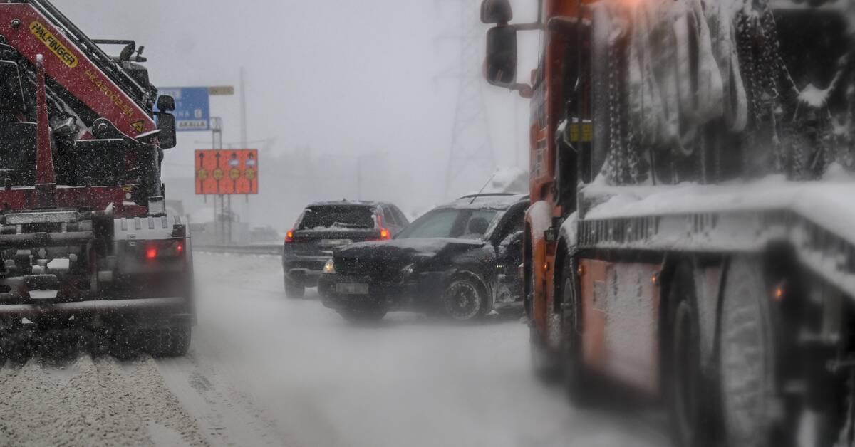
Queues and accidents
There were also slippery road conditions which led to major traffic problems.
Among other things, long queues formed, accidents and passenger cars and professional traffic got stuck in the snow.
- We still have some snow villages that remain mainly in northeastern Uppland and over northern Gotland, but most of the snowfall has passed and disappears further east during the night, says Emma Rosengren, meteorologist at SMHI.
New snow from the west
While Wednesday's snow storm is moving away from Sweden, several low pressures are moving towards Sweden from the west, and the cold air will remain next week as well.
- There is a line with slightly heavier snowfall tomorrow as well, which stretches from Greater Gothenburg and the Kungsbacka tracts up towards the Skövde tracts, says Max Schildt, meteorologist at SMHI.
The snowfall is then expected to move east towards Svealand, but will not be as heavy as on Wednesday.
- For Uppland and Sörmland, it will mostly be light snowfall during the afternoon and evening, says Schildt.
Mostly snow
Since the winter weather made a comeback, the most snow has been measured in Västergötland, the Stockholm archipelago, Roslagen and northern Östergötland in the last 24 hours, according to SMHI.
Javascript is disabled
Javascript must be enabled to play video
Read more about browser support
See some people struggling to get a car rolling and some other people falling over on the slippery road surface.
Photo: SVT