
China News Service, October 19th. According to the "Central News Agency", in the past few weeks, residents of communities along the Amazon River, the world’s largest river, began to lack water to drink, because seawater rushed into the mouth of the Amazon River, making it surround the state of Amapa in northern Brazil. The rivers of the Bailique became salty.
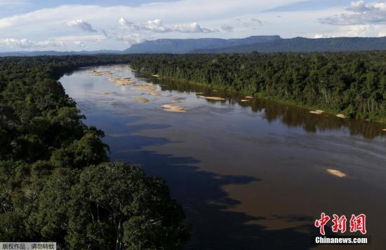
Data map: Rivers in the Amazon rainforest.
According to local residents, this phenomenon occurs on time every year, but it has intensified in recent years and has begun to affect previously unaffected communities. Therefore, the Macapa municipal government, the capital of the archipelago, declared a state of emergency on the 14th and began to report The community transports drinking water and basic food baskets.
Scholars studying this topic believe that the saltiness of the Amazon River may be related to the rise of global sea levels and is the result of climate change.
The Amazon River Mouth has undergone major changes in recent years. For example, the Araguari River has stopped flowing into the Atlantic Ocean since 2014 and has become a tributary of the Amazon River. This change may exacerbate the saltiness of the rivers surrounding the Balik Islands.
There are about 8,000 inhabitants in the Balik Islands, distributed on eight islands, about 200 kilometers from Macapa, and can only be reached by boat. The main economic activities are fishing, family farming and Açaí planting.
Geová Alves, chairman of the Belik Traditional Community Association and vice-chairman of the local Azahir Producers Cooperative, pointed out that the river water in this area becomes salty from September to November every year. During this period, there is less rainfall. The water level of the river usually drops, which is conducive to the tides rushing into the Amazon estuary.
Elvis said that in the past this seasonal salinization of river water only affected 20 of the 51 communities in the northern part of the Balik Islands. There is no running water and no money to buy mineral water. The river is the main source of water for local households.
Another effect of the river water becoming salty is the appearance of a large number of saltwater fish and the decrease of freshwater fish and shrimps.
However, this change is due to the high value of saltwater fish and the large catch, which is beneficial to fishermen.
As for the cultivation of Azahir, no changes have been found because the fruits are harvested in the rainy season, when the river water has become fresh again; unless the soil may affect the quality and quantity of production in a few years.
Many residents of the Balik Islands also attribute the salinization of the Amazon River to the siltation of the Araguari River, which is also a highly controversial topic in the local area and one of the biggest changes in the Brazilian landscape in recent decades.
The Araguari River is about 500 kilometers long and is the longest river unique to Amapa. It starts in the Tumucumaque National Park and flows into the Atlantic Ocean north of the Bailik Islands. It is only a few kilometers from the mouth of the Amazon River.
However, since 2011, a canal began to form between the two rivers, leading part of the Araguali River to the Amazon. This canal has been widening until 2014, almost absorbing the entire flow of the Araguari River, making the Araguali River. The Li River stopped flowing into the Atlantic Ocean and became a tributary of the Amazon River; after the changes in the Araguari River, the archipelago rivers became more salinized.
Alan Cavalcanti da Cunha, a professor of civil engineering at the Federal University of Amapa, pointed out that the other two possible causes of the increase in salinization of the Bailik River are related to climate change.
The first reason is the global sea level rise caused by the melting of polar regions.
According to NASA data, between 1901 and 2018, the average sea level rose by about 20 cm; when the tide rises, the river flow decreases, and it is easier for salt water to flow into the river.
Another possible reason is that climate change has caused the temperature in this area to rise, increase evaporation, accelerate air circulation, and allow the wind to bring more salt from the ocean to the continent.
Guya said that the changes taking place in the Amazon estuary need to be further studied, especially the impact of sea level rise; the area is extremely sensitive to changes, as rivers and lakes are interconnected, any changes may affect several kilometers away.
The changes in the Balik Islands have revealed one of the possible consequences of climate change on coastal populations. In addition to inundating many coastal areas due to sea level rise, many estuary communities may also face a lack of fresh water supply, forcing residents to relocate.