
The bad weather pulled past the southeastern parts of the landscape at lunchtime.
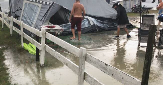
Campsites were submerged and buildings began to take in water.
Among those affected are Calmar city hotels.
- It went very fast, the rain poured in from the street, says hotel director Åsa Måård to SVT Småland.
Powerless after thunderstorms
A lightning strike in a transformer station is believed to be behind the extensive power outage that hit the city.
How many were affected is still unclear and shortly after 4 pm the power was back.
Further north, in Jönköping and the surrounding area, housing is affected by similar storms.
In Unnefors just outside Jönköping, the rescue service has received at least six alarms about flooded properties, reports SVT Jönköping.
Lightning strikes are also said to have caused a number of minor fires that could easily have been extinguished.
The thunderstorm has also led to power outages here, which just before 5 pm covered just over 4,000 households in Jönköping County.
"Continues obliquely upwards through the country"
Heavy rainfall was expected according to forecasters.
Now the rain area is moving further north, including towards Stockholm, according to SVT's meteorologists.
In addition, cooler air comes from the south.
- Therefore, real rain and thunderstorms are formed in the border zone to this warmer air, says meteorologist Pia Hultgren.
- It starts in southern Sweden.
We have had heavy rainfall over Kalmar and it continues obliquely upwards through the country, through Västergötland, up by Vänernlandskapen and Värmland.
Then this whole package is slowly moved further north during the night and into Wednesday.