
Above Central Europe is a low pressure and rotating.
This is what caused a heavy rain in several different places.
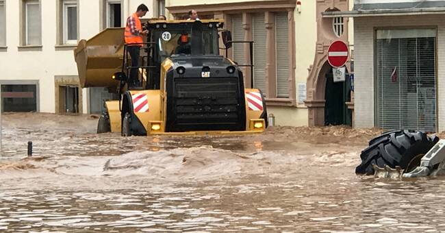
- In the last 24 hours, western Germany, Belgium, the Netherlands, France and Switzerland have received large amounts of rain.
In the hard-hit areas in western Germany, there has been 100-150 mm of rain, much of which fell in a short time, which resulted in floods, says meteorologist Marcus Sjöstedt.
"Local variation difficult to assess"
When there is rain in large amounts, it can be difficult for wells and stormwater pipes to take care of the water and there is a risk of flooding.
The moment of surprise makes the situation more difficult.
- It can sometimes be difficult to forecast this type of rainy weather.
There are often large local variations in where it rains and then also difficult to assess where the heaviest rain should hit.
The amounts that have fallen are what these areas normally see for a whole month, says Marcus Sjöstedt.
The low pressure will move to the southeast in the next few days.
It may continue to rain heavily, but it looks calmer right now.
However, we may see more floods like this in the future.
- In a warmer world, the risk of heavy rain also increases.
A warmer atmosphere can hold more water so there is more to give when the showers strike, says Marcus Sjöstedt.
Affected Sweden 2014
Heavy rains such as those in Central Europe are more common down on the continent than in the northern parts of Europe, although larger amounts of water have affected Sweden.
- An example is the downpour that Malmö was hit by on 31 August 2014. Then there was a lot of rain in a short time, about 100 mm or maybe even more.
It resulted in floods in several places, basements were filled with water and cars got stuck in the water masses, says Marcus Sjöstedt.