
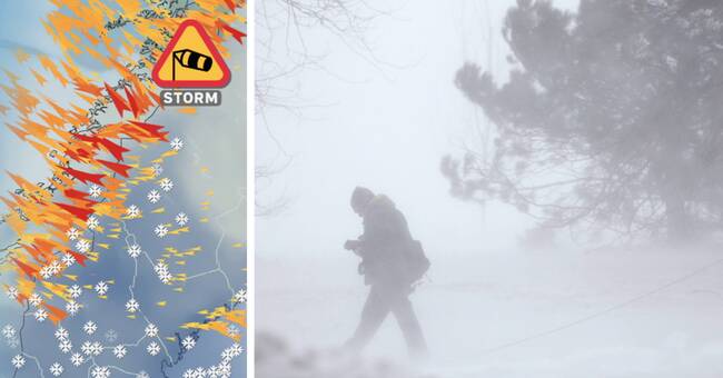
For the next 24 hours, it is more than wise to keep track of the weather in the northern Lapland mountains.
- It is very windy with strong gusts and hurricane villages.
The peak is reached on Thursday evening and Friday morning, says SVT's meteorologist Nitzan Cohen.
"Avoid going out"
In the high terrain, the storm strength will be around 25 meters per second and in minus 20 degrees the skin experiences it as -39.
- Sure, valleys can protect but avoid going out.
More warnings to wait
The brutal cooling effect is not the only problem.
The danger of avalanches is increasing and the prevailing rainfall is insidious.
- Right now it is fluffy powder snow that is falling and it impairs visibility, says Nitzan Cohen.
Cohen announces that more weather warnings are to be expected later this week when extensive snowfall draws up.
Problems with train snowflakes
The latest avalanche forecast in Abisko / Riksgränsfjällen is third on the five-point scale.
This means "significant avalanche danger" and, among other things, a new phenomenon is causing major concern.
“Train snowflakes are new and we have no information about it.
However, we suspect that it can be so sensitive that avalanches can be triggered even in flatter terrain ", writes lavinprognoser.se.
Click here to follow the avalanche development