
Share
02 October 2020The autumn storm is now over the north of Italy, but the critical day will be Saturday, with a red alert issued by the Civil Protection for Liguria, Lombardy and Veneto.
And Venice will be the city in the eye of bad weather, with an expected tidal peak of +135 centimeters, which for the first time will be faced by the Mose, the system of mobile dams that separates the lagoon from the sea.
Tested in recent months in an emergency phase - after the super-high water of +187 in November 2019 - the colossus formed by 78 gates at the 3 inlets will be tested during a real high tide.
An event that has been awaited for 54 years, since the storm of 4 November 1966 brought Venice to the brink of the abyss.
The whole machine for lifting operations is already in motion.
In the next few hours, the order of the Harbor Master's Office will be signed which tomorrow, from 7.30 to 15, will prohibit ships and merchant vessels from entering the lagoon, and will prohibit the approach to the 'mouths' of Lido, Malamocco and Chioggia by any means from pleasure.
It will not be like the dress rehearsal of 10 July last - which was also attended by Prime Minister Giuseppe Conte - when people saw the Mose 'show' rising in calm sea from the shores.
Sirocco winds of up to 50 km / h and waves of 2-3 meters are expected tomorrow.
The Mose is not finished yet;
technically Saturday will still be a functional test, to acquire data.
The technicians of the Venezia Nuova Consortium, the commissioner of the Mose Elisabetta Spitz, and the Provveditore for public works Cinzia Zincone trust that everything will go smoothly.
But in a situation of hydraulic stress there cannot be certain guarantees.
Between 9 and 10 should be given the go-ahead for lifting, on a theoretical target of 130 cm (the altitude fixed by the protocol) provided for at Punta della Salute.
Quota that, without the entry into operation of the barriers, could be reached at 12.05.
However, the Mose will rise first, and this will prevent the 'wave' from entering the lagoon.
At the moment of the peak, while outside the dams the tide level will be 130-135 centimeters, in the city - explained by the Provveditorato - it should reach 110 cm.
Basically, a 'normal' high water, which will flood Piazza San Marco and the lower areas, not 50% of the city soil.
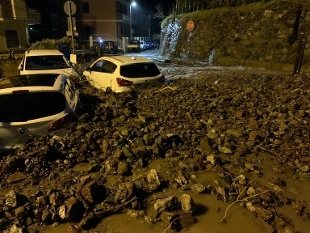
Meanwhile, the disturbance is already pouring heavy rains on Piedmont, with strong winds: the Arpa weather station in Rocca dell'Abisso (2775 m. In the Maritime Alps) recorded gusts at 142 km / h;
at Colle S. Bernardo, above Garessio, also in the Cuneo area, wind at 118 km / h.
In Limone Piemonte, 106 mm of rain fell in 3 hours.
The bad weather alert will involve most of the regions of Northern Italy, and beyond.
According to the Civil Protection, the vast perturbed system will extend tomorrow to part of the central regions, with widespread rainfall, thunderstorms, and a strengthening of the winds on the South and Sicily.
If the red alert has been issued for some sectors of Liguria, Lombardy and Veneto, the degree will be orange instead for Trentino Alto Adige, part of Valle d'Aosta, Piedmont, Friuli Venezia Giulia and Emilia Romagna.
In addition, storm surges are expected along the exposed coasts.
The phenomena will be accompanied by strong showers, frequent electrical activity, local hailstorms and strong gusts of wind.
For this reason, in Liguria the Arpal has raised the alert from orange to red, excluding only the Genoese and Savona area.