
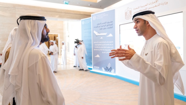
In the presence of His Highness Sheikh Mohammed bin Rashid Al Maktoum, Vice President and Prime Minister of the UAE and Ruler of Dubai, and His Highness Sheikh Mansour bin Zayed Al Nahyan, Deputy Prime Minister and Minister of Presidential Affairs, and directors of all municipalities in the Emirates, the results of the national project for the air survey of regions were announced Agricultural, using drones implemented by the Ministry of Climate Change and the Environment.
The Minister of Climate Change and Environment, Dr. Thani bin Ahmed Al-Zayoudi, presented to His Highness Sheikh Mohammed bin Rashid Al Maktoum, a detailed presentation of the project and its results, after the ministry implemented two phases of it, covering 1100 square kilometers, with an air survey using drone technologies, to collect data and information Comprehensive about 51 indicators in six emirates.
Al-Zyoudi stressed that the Emirates is working to enhance the employment of modern technologies and rely on innovative solutions to contribute to achieving sustainability at all sectors, pointing out that the air survey project for agricultural areas using drones contributes to building an integrated information base to enhance decision-making processes and draw strategies Future development of the agricultural sector in the country and achieve sustainability.
He said that the project contributes to the classification of the UAE among the five best countries in the world, in terms of the area that is surveyed using these technologies, and will be the first in the world that uses this technology to measure and erase many statistical data.
On the efficiency side of the project, he indicated that the cost of air surveying, through drone technologies, does not exceed 20% of the cost of conventional field surveying, while the reliability of information reaches between 90 and 95% for each statement.
The project aims to build an integrated statistical data base, which contributes primarily to supporting decision-making processes, drawing future policies and strategies, and also helps in developing the agricultural extension system.
The project's outputs and their implications are directly related to the farmers category, through their service in agricultural production processes, and providing them with higher income sources, and supporting the system of achieving food diversity. The project also supports farmers and decision-makers in future planning processes to market local production and ensure its abundance, and achieve self-sufficiency and expansion In organic farming, as well as building a statistical database on the numbers of farms and their areas, appropriate irrigation methods, and the quality and validity of arable soils.
It also aims to promote optimal exploitation of the environment and agricultural resources, and limit the numbers and areas of all types of farms, plant, animal and mixed, and identify the quality of the soil and its health to ensure abundance of production, and monitor the numbers and areas of land planted with trees «sustainable crops, seasonal crops, and field crops», and promote operations Supporting farmers, through drawing future plans and marketing local production, and identifying irrigation methods used in farms, and the numbers and types of refrigerated and non-refrigerated greenhouses and their locations, to support the agricultural extension system.
According to the distribution of the Emirates and its agricultural areas, the survey covered more than 188 square kilometers in Dubai, 276 square kilometers in Sharjah, approximately 332 square kilometers in Ras Al Khaimah, 52 square kilometers in the Emirate of Ajman, 65 square kilometers in Umm al-Quwain, and 135 square kilometers In Fujairah.
The Ministry had launched the pilot phase of the project, in August 2018, in Wadi Al-Aim in Ras Al-Khaimah to determine operational efficiency and reliability of information.
Al-Zyoudi also reviewed the "Smart Farmers" application project, which provides an integrated package of informative information for farmers and livestock breeders, with the aim of achieving sustainability in the agricultural and animal sector in the country.
The application will allow the customer to communicate directly with the owners of specialization in the agricultural and veterinary fields, through the feature of “communicate with the specialist”, to apply to the ministry's services related to farmers and livestock, and to review the status of requests in a simple and easy way, without the need to review the centers for the happiness of dealers.
Smart counseling
The "Our Farms" application project represents the smart and advanced stage of the "My Farms Sustainable" electronic project for agricultural and veterinary extension, which was launched by the Ministry of Climate Change and Environment, last October, with the aim of developing a field extension services system for these two vital sectors, in order to ensure raising their production efficiency and achieving their sustainability.
The application is characterized by its simplicity in its design, which facilitates the quick access of the customer to the services, and provides various channels to provide smart guidance through agricultural and veterinary guidelines, videos and awareness data for both farmers and livestock keepers.
The agricultural calendar tool in it also allows to know the recommended dates and seasons for different crops, and the "agricultural plan" feature provides, in the application, to the customer the possibility of entering his agricultural plan, to receive alerts and instructions related to the type of crop that is planned to grow.
Project results:
- Supports farmers and decision-makers in future planning processes for marketing local production and ensuring its availability, achieving self-sufficiency and expanding organic agriculture.
- Provides a statistical database on the number of farms and their areas, appropriate irrigation methods, the type of soil suitable for cultivation and its validity.
Project characteristics:
- The UAE is the first in the world in the use of the technology of agricultural statistical survey in drones.
The project covered 1,100 square kilometers in six emirates, to build a statistical database.