
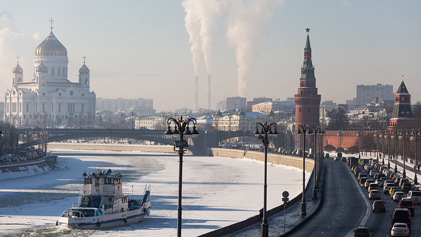
After a long period of abnormally warm weather, cooling came to the capital. On February 4, in the capital, the thermometer columns dropped below zero.
At the same time, on Friday, February 7, residents of the capital are expected to have a frosty temperature of -15 ° C, said Roman Vilfand, scientific director of the Hydrometeorological Center of Russia, to TASS.
“On February 7, -10 ... -15 ° С is forecasted at night, during the day it is also not hot at all - -7 ... -12 ° С. Here the temperature will be near normal, and probably below normal. It can be just a degree below the norm, but in the context of abnormally warm weather this will be unbelievable earlier, ”the meteorologist explained.
On the night of February 8, according to the forecast of the Hydrometeorological Center, the temperature may drop to -17 ° C. But already at the beginning of next week the cold will recede. The temperature in Moscow will again be slightly below zero.
A similar forecast is given by Gismeteo. The portal promises the first days for this winter with a double-digit negative temperature.
“In the second half of the week, the cooling will intensify. We are waiting for the first frosty weather this season with a two-digit minus, not only at night, but also in the daytime. According to calculations, the temperature will be -15 ... -18 ° С at night, during the day - about -10 ° С. For the first time this season, the average daily temperature will be below the climatic norm, ”says the Gismeteo website.
Wind, snow and pressure surges
Yevgeny Tishkovets, a leading specialist at the Phobos weather center, notes that lowering the temperature in the metropolitan area will be accompanied by snowfalls, gusts of wind and icy conditions.
“This (cooling. - RT ) will be accompanied by short charges of snow, gusts of wind and sleet. On Thursday, we will return to the framework of the climatic norm, it is -4 ... -9 ° C in the afternoon. Further it will be even worse. On Friday night -10 ... -15 ° C, during the day -5 ... -10 ° C. On Saturday, -12 ..- 17 ° C at night and -6 ... -11 ° C during the day. This will be alternated by the sun, then by the clouds, ”he told RT.
Tishkovets emphasized that a pressure change is expected against the background of a sharp drop in temperature. Only by the beginning of next week can we expect a softening of weather conditions, the leading specialist of the weather center “Phobos” predicted.
“Cooling is powerful. And the pressure will jump very much. By the weekend, we will be in a bag of Arctic cold and at the very bottom of the frosty well, at the lowest rates. I think that this will last until Sunday inclusive, then the cold will release, ”said the weather forecaster.
As Tatyana Pozdnyakova, chief specialist of the metropolitan meteorological office, explained, another cyclone will pass near Moscow, but the capital will be in its rear part. That is what will cause the cooling.
“The weather will be determined first by the rear of one of the cyclones, which today pass along the cold front and go east. We were in its rear part, and in our rear of this cyclone an objection of colder air will begin. We expect that the temperature drop will be due to the invasion of colder air, ”she said in a conversation with RT.
Pozdnyakova also added that the capital’s weather bureau expects that “this period of frosty weather will not be long”.
Warm winter
According to Tishkovets, the outgoing January was the warmest in more than a century of history of observations.
“He was record warm for a 130-year history of observations. The average daily temperature was above zero, this is unbelievable, ”said the weather forecaster.
To gallery page
Anatoly Tsygankov, deputy head of the Roshydromet situational center, noted that the first two months of winter were not only very warm, but also accompanied by heavy rainfall.
“The previous two months we really were very warm. In January, there was practically no day for the daily average temperature to be lower than normal, with the excess being 10-12 ° C higher than normal. Although we completed 130% of precipitation, there was a lot of precipitation, but everything melted, in the form of rain and wet snow, that is, there is very little snow. The reason for this is cyclones, which were more active and warm air from the Atlantic, it passed through Western Europe, through Belarus to the Volga, ”he said in a conversation with RT.