
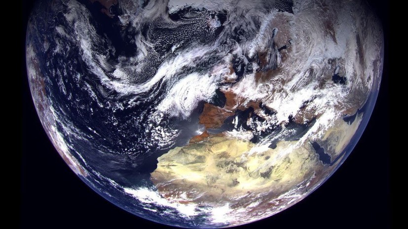
The "new" polar "satellite" Arktika-M "has sent the first images.
The first images from a highly elliptical orbit from an altitude of 30 and 37 thousand km, respectively, were made by a multi-zone scanning device (MSU-GSM) of the new Russian Earth remote sensing spacecraft "Arktika-M" No. 1, launched from Baikonur on February 28, "Rogozin wrote in Telegram.
He noted that the quality of "raw" (unprocessed) images fully meets the expectations of specialists.
At the end of February, a Soyuz-2.1b launch vehicle with the first Russian satellite Arktika-M was launched from Baikonur to monitor the climate and the environment in the Arctic region.
According to Rogozin, this launch "had to be more worried than usual", because due to the wind, the Soyuz-2 launch was "at the very limit of tolerance for meteorological conditions," but "the rocket and its control system coped brilliantly."