
A new study revealed that the chances of earthquakes in the western Mediterranean basin leading to devastating tsunamis are greater than previously expected by scientists.
The researchers, who for the first time determined the location of the boundary separating the African and Eurasian plates in the western Mediterranean, confirmed that this new discovery raises the possibility of this type of devastating disaster, which scientists expected that the Mediterranean would witness one of them during the next three decades.
geologically active areas
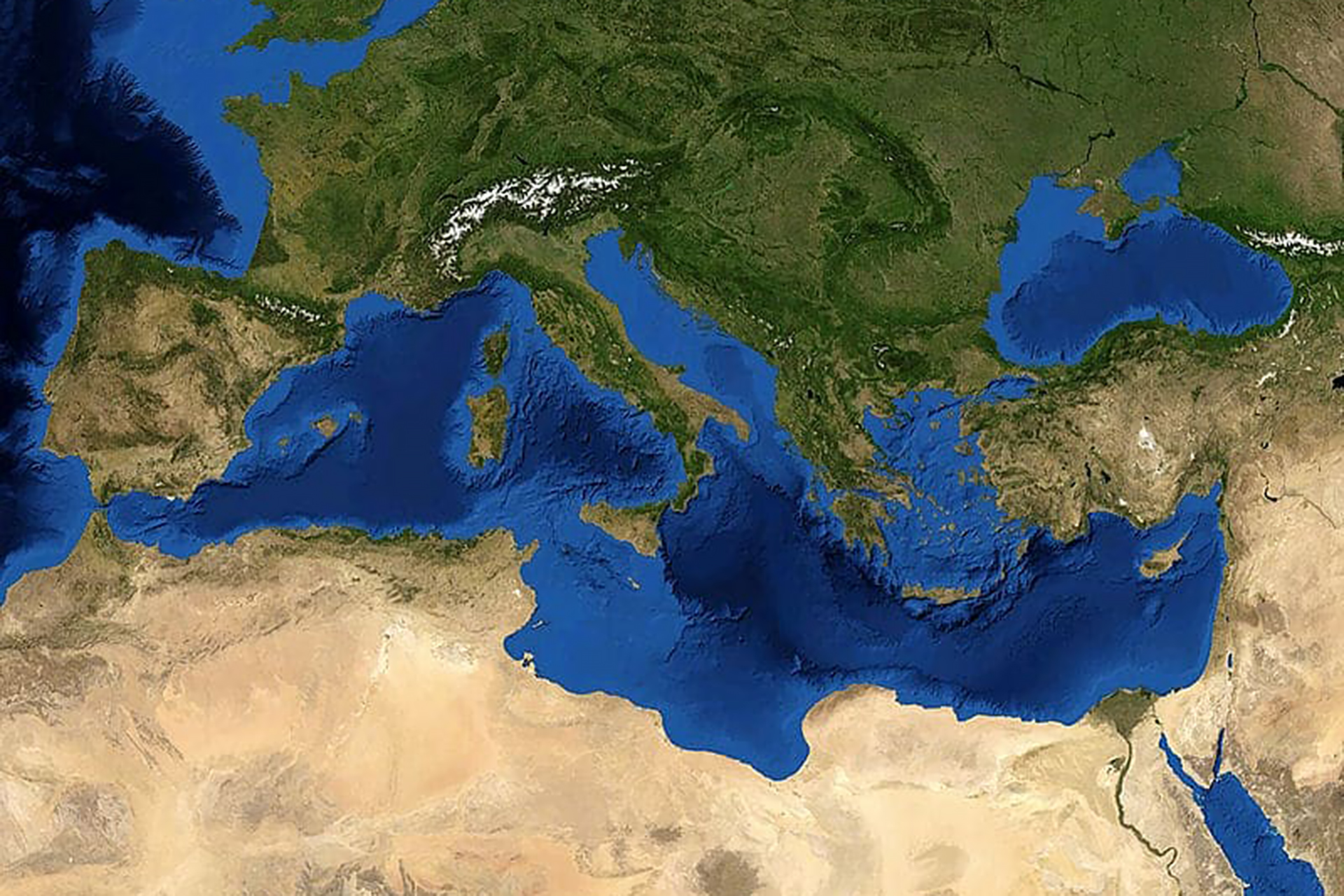
The Mediterranean Sea is one of the geologically active regions as a result of the collision of the African plate with the western part of the Eurasian plate.
This collision, which has been going on for about 65 million years, led to the formation of the Alps and the shrinking of the Mediterranean Sea, at a time when the African plate continues to move north by about 2.5 centimeters per year, subducting under the European plate, resulting in frequent seismic and volcanic activities.
Although the geological structure under the surface of the Mediterranean has been studied on a large scale, the data that has been available so far for some areas has not been sufficient to accurately know the boundaries between the two plates, and to understand the tectonic activity around them.
According to a press release published by the Institute of Marine Sciences in Barcelona (Institut de Ciències del Mar) on the 23rd of last month, the new scientific paper - which was recently published in the journal "Nature Communications" - identified for the first time the complex geometry of the system of active rifts under The surface of the Alboran Basin, located in the western Mediterranean between the Moroccan, Algerian and Spanish coasts, described how it had moved over the past 5 million years.
The accuracy of the data, on which the study was based, enabled a detailed characterization of the active fault system extending for more than 300 km. The results showed that fault systems in the region absorb most of the deformation caused by the collision of the Eurasian and African plates.
The researchers considered that the results of the study are essential for re-evaluating the risks of earthquakes and tsunamis to coastal areas in the western Mediterranean, especially since most of the previous studies on the risks of earthquakes and tsunamis did not take into account the importance of the faults under the Boran Sea due to lack of data.
The Mediterranean witnessed many violent tsunamis, most of which resulted from strong earthquakes and landslides (Getty Images)
Tsunami waves in the history of the Mediterranean
Historically, the Mediterranean Sea witnessed many violent tsunami events, most of which resulted from strong earthquakes and landslides that occurred in the fault systems along the borders between the African and Eurasian plates.
And nearly a century has passed since the last major tsunami in Europe, a wave that reached a height of 13 meters caused by an earthquake that occurred below the depths of the Mediterranean off the coast of Sicily in 1908 and killed about two thousand people.
But tsunamis in the Mediterranean could be more destructive, according to an article by Matthew Blackett, professor of physical geography and natural hazards at Coventry University, published on the Greek Reporter website.
A large volcanic eruption on the island of Santorini about 3,500 years ago led to a wave that completely destroyed the Minoan civilization, and the incident may have led to the emergence of the legend of the disappearance of the Atlantis civilization.
A group of earthquakes, some of which had a magnitude of 8.5 on the Richter scale, struck the coast of Crete in the year 365 AD.
The tsunami destroyed some ancient cities in Greece, Italy and Egypt, killing around 5,000 people in Alexandria alone.
As for the western Mediterranean, not far from the Alboran Basin, which was included in the last study, the last tsunami the region witnessed dates back to 2003, when a strong earthquake hit the Boumerdes region on the Algerian coast, which led to the emergence of tsunami waves that reached a height of about two meters, and caused damage to the beaches of the Spanish Balearic Islands, which It is about 300 km north of the epicenter.
What about the future?
According to estimates published by The Guardian newspaper prior to the release of the results of the latest study, quoting experts from UNESCO, the risk of a major tsunami occurring within the next 30 years, during which the wave height exceeds one meter, is nearly 100%.
These waves are likely to hit large cities on the Mediterranean coast, such as Marseille, Alexandria and Istanbul.
Scientists expect that sea level rise will increase the risk of tsunamis in the Mediterranean.
A scientific study showed that a 45-centimeter rise in sea level could double the risk of floods resulting from seawater sweeping into land by about two and a half meters.
According to Blackett, the risks are also exacerbated by the fact that the Mediterranean Sea is relatively small and closed, which means that any tsunami could spread throughout the basin, on whose coasts more than 130 million people live.
The warning times necessary to minimize casualties will also be short.
According to the Guardian, all threatened residential communities will be ready to respond by 2030 to deal with such events thanks to the early warning system that UNESCO has been focusing on since 2004.
Since the risks revealed by the new study were not taken into account, it is likely that the supervisors of the warning system will have to reconsider the list of residential communities that are definitely threatened by tsunami waves.