
From Sunday to Wednesday, the country is affected by an air depression from the east
«National Meteorology»: The hot weather will continue until Friday... and rain forecasts on Saturday
The National Center of Meteorology expected the weather today to be hot and fair to partly cloudy at times.
Photography: Ashok Verma
The country will be affected, starting next Sunday, by an extension of an air depression from the east.
Photography: Najeeb Mohamed
picture
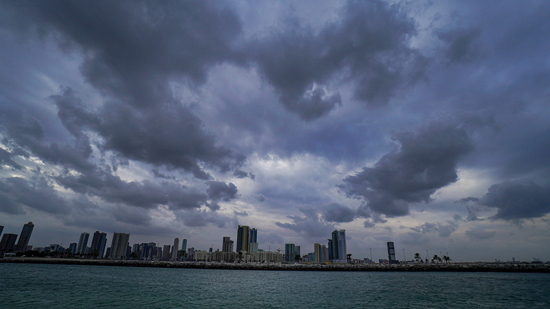
The country is witnessing an extension of a shallow air depression, accompanied by a weak air depression in the upper layers of the atmosphere, which led to the weather being hot and clear to partly cloudy at times, and the appearance of clouds to the east in the afternoon, and humid at night and today as well. The National Center of Meteorology announced that the highest temperature recorded in the country yesterday was 51 degrees Celsius in Sweihan (Al Ain) at 12:30 pm, while the lowest temperature recorded in the country yesterday was 26.2 degrees Celsius in Al Foah (Al Ain) at 06:00 am. UAE local time.
The National Center of Meteorology expected that the weather today will be hot and clear to partly cloudy at times, and clouds will appear in the east in the afternoon, and humid at night and Thursday morning on the coasts, and the winds will be southeasterly to northeasterly light to moderate, and active at times, causing dust, with a speed of 15 to 25 reaching 40 km/hr, the sea is light in the Arabian Gulf and light to medium in the Oman Sea.
The center indicated that the weather tomorrow, Thursday, is hot and clear to partly cloudy at times, and clouds appear to the east that may be convective in the afternoon, and the winds are southeasterly to northeasterly light to moderate, speedy and active at times, with a speed of 15 to 25 up to 40 km / h, and the sea is light. Waves in the Arabian Gulf and light to medium waves in the Sea of Oman.
The center pointed out that the weather will continue on Friday, hot and clear to partly cloudy at times, with a chance of cumulus clouds forming in the afternoon from the east, and the winds will be southeasterly to northeasterly light to moderate in speed and active at times, with a speed of 15 to 25 up to 40 km / h, and the sea Light to medium waves in the Arabian Gulf and in the Sea of Oman.
On Saturday, August 13, the National Center of Meteorology expected that the weather will turn partly cloudy to cloudy at times, with a chance of convective clouds in the afternoon east and south, accompanied by rain. Sometimes with clouds that raise dust and dust, and their speed is from 20 to 30 up to 40 km / h, and the sea is light to medium waves in the Arabian Gulf and in the Sea of Oman.
While the country will be affected from Sunday, August 14 to Wednesday, August 17, by an air depression from the east, with a chance of rain falling on areas of the country, especially the eastern and southern regions.
According to the National Center of Meteorology, the month of August is witnessing a rise in temperature, as the country continues to be affected during this month by the extension of the Indian seasonal depression, as well as thermal depressions from the southwest that lead to a noticeable rise in temperature.
Cumulonimbus clouds form over the eastern regions of the country due to the flow of moist air masses from the east. With the presence of the eastern mountains and high temperatures, cumulus rainy clouds develop in the afternoon and then move towards the interior regions. Some regions of the country are also affected during this month, especially in the first half of it. Along the Intertropical Convergence Line (ITCZ), which is accompanied by the formation of cumulus rain clouds over separate areas, especially the southern and some western areas.
• 51 highest temperature recorded yesterday.
Follow our latest local and sports news and the latest political and economic developments via Google news