
The rain will start in southwestern Sweden and then move further up to the central parts of the country.
- There are two low pressures that become one, with split rain and showers, says Nils Holmqvist.
Skåne, Halland and Kronoberg are expected to receive rain tonight.
On Tuesday and Wednesday, it continues to Västmanland, Uppland, Dalarna, Gävleborg and Västernorrland.
- There will be no persistent rain around the clock over these areas, but there may be occasional heavy showers, says Nils Holmqvist.
"Risk of a full month of precipitation"
The rain also brings with it strong gusts and slightly lower temperatures.
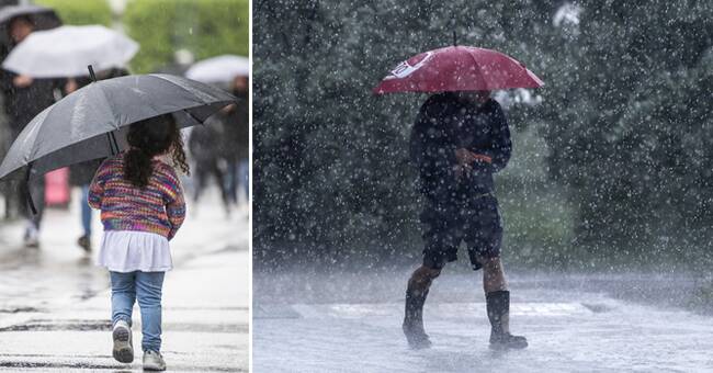
- There will be many windy umbrellas.
The temperature will be 10 to 15 degrees, so it will be a taste of autumn, says Nils Holmqvist.
August has so far been somewhat colder than normal, and it looks like it will continue like this for the rest of the week.
- 10 to 15 degrees in large parts of the country and southern parts can get up to 20 degrees.
According to SMHI, there may be 70 to 100 mm of rain, which is more than what usually comes in a whole month in Uppland and southeastern Norrland.
- There may be a risk of a whole month of precipitation within the course of a day, says Ulrica Sievert, meteorologist at SMHI.
Difference between risk and warning
At present there is a risk of heavy rainfall, but it could be a class 2 warning.
- A risk is issued when there is a certain probability of a class 2 warning, which can be now with heavy rainfall, says Ulrica Sievert.
SMHI may issue a risk up to 72 hours before the expected weather event, while a warning may not exceed 24 hours before.
- But just because you take a risk does not necessarily mean that it will automatically be a class 2 warning later, it is more that you flag it but it can also be a class 1 warning.
Prior to a possible class 1 warning, no risk is usually issued before.