
Share
by Tiziana Di Giovannnadrea
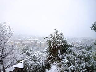
20 March 2021 Bad weather affects a large part of the Peninsula due to the effects of the vast perturbation active to a large extent on Europe, which will still cause bad weather on central-southern Italy on Sunday 21 March, with rains and thunderstorms in the South and snow on the southern inland hilly areas.
The unseasonal cold will be accentuated by strong northern ventilation.
On the basis of available forecasts, the Civil Protection Department assessed for Sunday an
orange alert
on part of
Sicily
with hydrogeological risk and
yellow alert
on the remaining sectors of the island due to water risk, as well as in
Basilicata
,
Calabria
and in the
Lower Fortore
in
Puglia
.
From late Saturday evening, the notice foresees strong to stormy winds from the northern quadrants over Sicily, especially the eastern sector, and Calabria and Basilicata, especially the Ionian sectors, in extension to Puglia, especially the southern sectors.
Sea storms on the exposed coasts.
The alert also anticipates the persistence of scattered rainfall, also of a reverse or thunderstorm character, on Sicily and Calabria, in extension to Puglia, especially southern sectors.
The phenomena will be accompanied by strong showers, frequent electrical activity and strong gusts of wind.
Finally, snowfalls are expected to persist above 800-1000 m in central-northern Calabria, with moderate contributions to the ground, up to abundant at higher altitudes.
In
Lazio
,
Tuscany
,
Umbria
is expected transit passing cloud, while in the rest of the country is expected to be cloudy to overcast sky.
The
temperatures
have gone south.
A further drop of even 7 degrees compared to the average for the period is announced, with probable frosts widespread in the north at dawn.
In
Piedmont
the minimums remain below zero in many locations, last night the minimum was -1 in the center of Turin.
On Monte Rosa it was -29.7 degrees.
Temperatures below zero are also expected
in
Veneto
,
Lombardy
,
Trentino
and
Emilia Romagna
.