
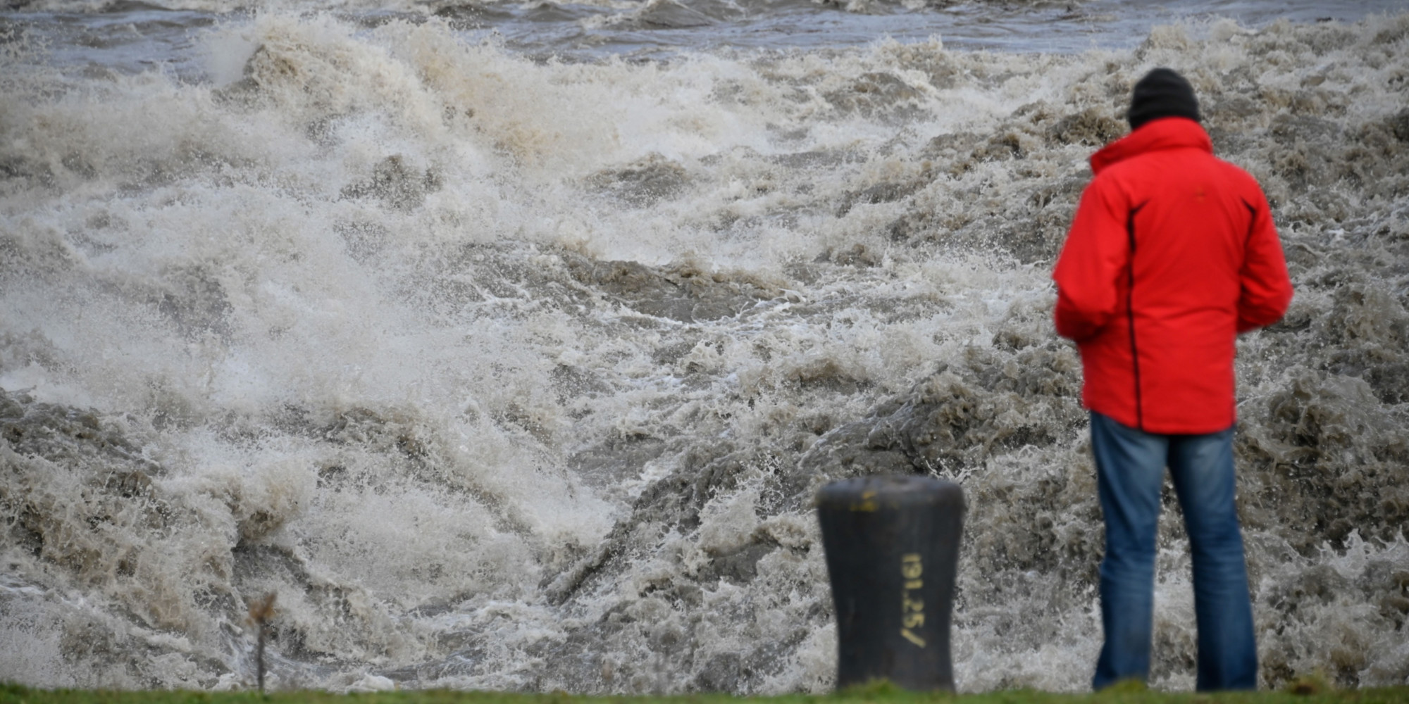
About twenty departments are placed on orange vigilance, Saturday, for floods, rain and flooding, some for avalanches and others for waves and submersion.
Among the departments concerned, Hautes-Alpes, Isère, Savoie and Haute-Savoie, as well as the coasts of Finistère, Morbihan, Gironde and Landes.
The metropolis will still experience a lot of rain and wind on Saturday, with sometimes quite strong gusts and some snowfall, Météo-France announces, which has placed 20 departments on orange vigilance.
Orange vigilance for floods is in effect for certain rivers in Normandy, Ile-de-France, Hauts-de-France, Grand Est, Franche-Comté, Rhône-Alpes and Aquitaine.
The Jura and the Doubs are on orange vigilance for rain and flooding.
The Hautes-Alpes, Isère, Savoie and Haute-Savoie are always on orange alert for avalanches.
Corsica, on the other hand, is no longer placed in orange vigilance for strong winds.
Finally, a new orange vigilance for waves and submersion concerns the coasts of Finistère, Morbihan, Gironde and Landes.
20 deposits in #vigilanceOrange
Stay informed on https://t.co/CSYEovTI83pic.twitter.com/l1TdxyVgLz
- VigiMeteoFrance (@VigiMeteoFrance) January 30, 2021
Météo-France calls for caution near the Belgian border
During the night from Friday to Saturday, a new Atlantic disturbance, rainy and very windy, will arrive from the west, watering mainly the north-west of the country.
The wind will be strong enough.
On Saturday, in connection with the Justine depression, the disturbance that arrived the day before from the north-west will give often moderate rainfall in the morning, from the Pyrenees to the north-east and north.
But Météo-France calls for caution near the Belgian border, where snow will mix with rain.
With the cooling at the end of the day, a thin layer of snow on the ground is possible in the Nord-Pas de Calais, under a moderate easterly wind.
In the west, after a slight lull, the rains will resume at midday, with the wind at times quite strong.
The gusts will reach 80 to 90 km / h in the Atlantic regions, temporarily 110 km / h on the coast at the end of the day.
Be careful, strong waves are to be feared at the end of the day on the coasts of Finistère and Morbihan.
During the day, the rainy weather will block in the east of the country, as far as the east of Provence, with a rain-snow limit which will drop from 1,800 to 1,300 m.
A few thunderstorms will break out near the Côte d'Azur and Corsica.
The wind will remain strong at the edge of the Mediterranean, with a tramontana at 100 / 110km / h in the afternoon, and peaks at 100 / 130km / h on the Corsican capes at the end of the day.
Showers will increase in the southwest.
It will snow at around 1,300 m in the middle of the day in the Pyrenees.
The west wind will also blow quite strongly at the foot of the Pyrenean massif.
Temperatures will be stationary and always mild, with 5 to 11 degrees for the minimum, locally 12 in the Southwest.
Maximum temperatures will drop slightly from 7 to 13 degrees in the northern half and 11 to 15 in the south, to 16/17 in the extreme southeast.