
From heat to frost: whitewash the islands of Lipari and Ponza
Bad weather, the great cold arrives.
Rain and snow over half of Italy
Share
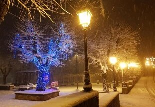
28 December 2020A thick layer of fresh snow has whitened Milan and Lombardy.
In the city,
the white blanket is between 5 and 10 cm
, with the main roads already clean and the secondary ones still covered with snow.
The snowfall affected the whole region, including the city of Sondrio with the exception of the south-eastern plain where it falls mixed with rain, creating
greater inconvenience in Valtellina and Valchiavenna
where the Alpine passes have been closed or can only be traveled with mounted chains.
In these areas there is a fear of the exodus of herds of deer and chamois towards the valley floor in search of food.
The Lombard capital, which returns to the 'orange' alert, appears even more silent at dawn, while the snow continues to descend relentlessly.
According to forecasts, however, the
precipitation should end already in the afternoon
and in the next few days days with overcast or partly cloudy skies are expected.
"From Monday afternoon - specifies Arpa Lombardia - attenuation and exhaustion of rainfall in the plains, weak on the reliefs until Tuesday, therefore running out".
On the Peninsula, a disturbance brings cold and snow to the North where mostly cloudy weather is expected in all regions, with snow phenomena even in the plains and more intense on the Emilian Apennines and Triveneto, the Air Force reports.
Between
late morning and afternoon
there will be a tendency to attenuate the phenomena on the Piedmontese plains and on western Liguria.
Between the
afternoon and the evening,
temporary brightening of the southern sectors of Piedmont, Lombardy, Veneto and Friuli-Venezia Giulia and general attenuation of the phenomena, except on Val d'Aosta and reliefs of western Piedmont.
In the center, very cloudy weather over the Tyrrhenian regions, Umbria and north-central Sardinia with precipitation also of a thunderstorm character starting from northern Tuscany, rapidly extending to the remaining center and snow level on the Apennine areas above 1000 meters.
In the evening, attenuation of the phenomena with the exception of upper Tuscany and partial bright spells over Sardinia, Tuscany and the northern sectors of Marche and Umbria.
To the south, many clouds over Sicily, Campania, Tyrrhenian Basilicata, Molise and Gargano Puglia with local showers on the peninsular areas and temporary intensification in the afternoon;
large areas of serene elsewhere.
Minimum temperatures rising in the central regions, especially in Sardinia, Tuscany and upper Lazio;
Stationary or slightly decreasing in the remaining areas: maximum decreasing slightly in Liguria and Valpadana and generally increasing in the rest of the country, especially in central regions and northern Puglia.
Winds and seas
Storm winds on Liguria, Emilia Romagna, central regions, Veneto and Friuli coasts and subsequently also in the south with afternoon attenuation in the north east;
moderate variables on the remaining north.
Seas from very rough to locally large the Sardinian Sea and the Central Tyrrhenian;
the Ligurian Sea, the Sardinian Channel and the Upper Tyrrhenian Sea are very agitated;
from agitated to very agitated the remaining seas and channels of Sardinia.
Bad weather on New Year's Eve
"The end of the year is expected with bad weather in all of Italy", reports the Italian Weather Center which announces in the coming days disturbances and cold throughout the peninsula with abundant snow on the northern regions in many cases up to the plains.
The snowfalls will also affect the cities of Turin, Piacenza, Milan, Bergamo and Brescia and the eastern Po Valley.
Abundant snow expected in the Alps, especially in the eastern ones.