
Bad weather.
Yellow alert in 12 regions for wind and storms
Bad weather, Piedmont: bell tower collapses.
Sixth body in the sea was spotted in Liguria
Bad weather in the North West, six more victims.
Piedmont and Liguria are asking for a state of emergency
Bad weather, red alert in the North: floods in Piedmont, 16 missing
Share
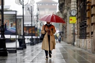
14 October 2020The perturbation that until tomorrow afternoon will cross the whole of Italy from North to South arrives from the Atlantic. A large depression area positioned over most of Europe continues to determine a phase of bad weather also in Italy with widespread rainfall and a general reinforcement of the winds.
The Department of Civil Protection, in agreement with the regions involved - which are responsible for activating the civil protection systems in the territories concerned - has issued a further warning of adverse weather conditions.
The weather phenomena could determine hydrogeological and hydraulic criticalities in various areas of Italy.
From today, the notice provides for widespread rainfall with a prevalent reverse or thunderstorm character, over Tuscany and Campania, in extension, from the night, first over Lombardy, Veneto, Friuli Venezia Giulia and subsequently to Sicily, especially the south-eastern sector, Basilicata, especially Tyrrhenian sector, Calabria and southern Puglia.
The phenomena will be accompanied by strong showers, frequent electrical activity, local hailstorms and strong gusts of wind.
Also expected from late evening today, strong to stormy winds from the southern quadrants on Abruzzo, Molise and Campania, with possible storm surges on the exposed coasts.
On the basis of the forecasts, an
orange alert
was assessed until Thursday 15 October
on most of
Campania
, on
southern
Puglia
, on the Apennine sectors of
Abruzzo
, on the territory of
Lazio
and on
southern
Veneto
.
Yellow alert over much of the country.
Campania: schools and parks closed in Naples
Tomorrow, Thursday 15 October, schools of all levels will remain closed, including nursery schools, parks, cemeteries and city sports facilities.
The alert reports the following critical issues on the territory: "widespread rainfall, with a downpour and thunderstorm, locally of strong intensity. Strong winds from South-South-West with gusts. Agitated sea, with possible storm surges along the exposed coasts".
The school department underlines that - without prejudice to the autonomy of the school institutions - the possibility of allowing access to school operators for the purpose of activating the distance teaching or integrated digital teaching paths and all the other planned operations.
The city parks, including the Virgiliano sports facility, have already been closed since this afternoon.
Lazio: 36 hours of alert
The Regional Functional Center announces that the Civil Protection Department has issued today "the warning of adverse weather conditions in Lazio: scattered to widespread rainfall, predominantly of downpour or thunderstorm character. The phenomena will be accompanied from strong showers, frequent electrical activity, local hailstorms and strong gusts of wind. Strong to gale force winds are also expected from the southern quadrants, to rotate from the western quadrants. Storms along the exposed coasts ".
Venice: high water in the center
Important showers are expected in Veneto until the early hours of Friday 16 October.
Locally intense phenomena are also possible.
At the same time, high water is expected in the historic center of Venice: the Centro maree foresees a possible peak of 135 centimeters at 10.45 tomorrow, Thursday 15 October, followed by a possible tide of 120 centimeters at 11.10 the following day and a peak of 105 centimeters at 11.40 on Saturday 17 October.
Trieste: high water and storm surges
Risk of high water in Trieste tomorrow, at the tide peak expected in the morning and the storm surges connected with the sustained wave motion.
This was announced by the Civil Protection of Friuli Venezia Giulia.
Generally abundant rains are expected for tomorrow, especially in the Carnic Prealps.
It will blow moderate Bora in the lowlands, from sustained to strong on the coast.
Snow over 1800-1600 meters in the Prealps, 1500-1200 meters in the Alps with lowering snow levels up to 700-800 on the Tarvisiano.