
China News Service, September 3 According to South Korea’s "Joongang Ilbo", Typhoon No. 9 "Mesaq" landed in South Korea in the early morning of the 3rd local time and left northward.
At the same time, Typhoon No. 10 "Poseidon" has also been generated.
The Korea Meteorological Agency predicts that "Poseidon" will land on the South Sea coast of South Korea on the morning of the 7th local time, running through the central inland area.
According to the Korea Meteorological Agency, Typhoon "Poseidon" may make landfall in Tongyeong, Gyeongsangnam at around 8 am on the 7th, arriving in Haman, Gyeongbuk, Gangwon-wonju and Chuncheon successively.
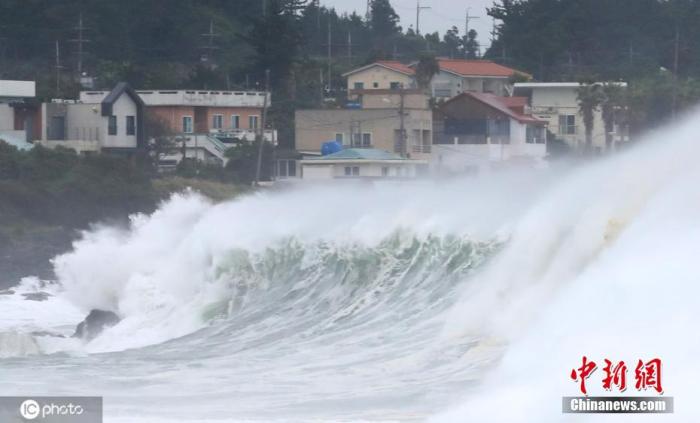
On September 2, local time, the super typhoon "Mesaac" affected South Korea, which caused huge waves off Seogwipo, Jeju Island.
Image source: ICphoto
Previously, "Poseidon" was expected to pass through the Japanese archipelago through the sea of Kagoshima, Japan, but the updated forecast on the 3rd showed that the path of "Poseidon" has changed and is expected to pass through inland Korea.
According to the report, as of 3 a.m. local time on the 3rd, Typhoon Poseidon was moving west-northwest at a speed of 19 kilometers per hour in the waters around 920 kilometers northwest of Guam.
It is expected that "Poseidon" will travel north to about 1100 kilometers southeast of Okinawa, Japan at the same time on the morning of the 4th, and will travel north to the sea area about 240 kilometers south of Busan on the morning of the 6th.
At 3 o'clock in the morning on the 7th, close to inland, the intensity of the typhoon is expected to reach "very strong".
The Korea Meteorological Agency predicts that the central pressure of "Poseidon" will reach 945 hPa, the maximum wind speed will reach 162 kilometers per hour (45 meters per second), and the strong wind radius will be 440 kilometers.
Under "very strong" intensity, the wind can blow people or big rocks away.