
China News Service, September 2-According to the Associated Press, the National Hurricane Center revealed that tropical storm "Omar" formed on the east coast of the United States on the 1st, while tropical storm "Nana" was approaching the coast of Central America.
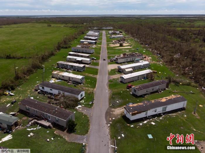
On August 27, local time, Category 4 hurricane "Laura" made landfall in Cameron Parish on the southwest coast of Louisiana, USA. The maximum sustained wind speed was 150 miles per hour.
The picture shows the damaged house.
Weather forecasters predicted that "Nana" would intensify into a hurricane when it landed on the 3rd, and said residents of Honduras, Guatemala, Belize and Mexico's Yucatan Peninsula should pay close attention to the trajectory of the storm.
Strong winds, dangerous storm surges and heavy rainfall are likely to cause flooding.
According to reports, "Nana" is moving westward at a speed of 30 kilometers per hour, which may cause damage to Central America on the 2nd and 3rd.
According to Professor Phil Crotaz Bass of Colorado State University in the United States, "Nana" and "Omar" are the 14th and 15th storms to be named the earliest in record.
The U.S. Hurricane Center predicts that tropical storm "Omar" will not last long.
On the evening of the 1st local time, the maximum continuous wind speed of the storm was 65 kilometers per hour, and no change is expected at night.
"Omar" was 365 kilometers east of Cape Hatteras, North Carolina, and was moving east-northeast at a speed of 24 kilometers per hour.
The weather forecaster predicted that it would weaken on the night of the 2nd.