
How many steps are there to "蹭" GPS on the moon?
The future moon may have its own satellite navigation system
NASA and other media recently released news that in order to achieve the goal of returning to the moon, NASA scientists began to perform "lunar navigation" verification. They said that the signals transmitted by GPS satellites in the earth's orbit can be received and used on the moon, and the positioning accuracy can reach 200 meters to 300 meters.
Can I use the GPS signal to get on the moon? "This method works," Yang Yuguang, a researcher at the Second Academy of China Aerospace Science and Industry Corporation, told a reporter from Science and Technology Daily.
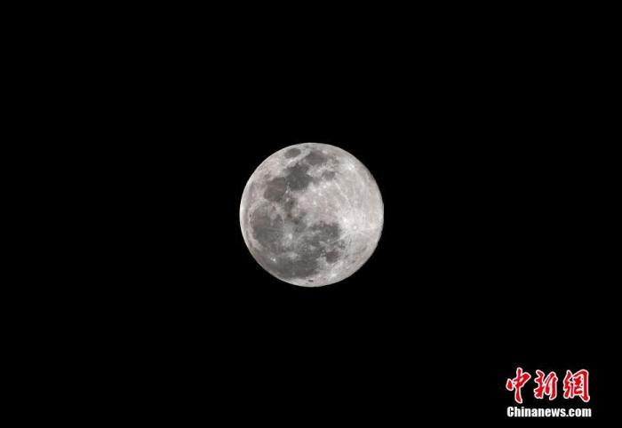
On March 10, in Nanning, Guangxi, a full moon rose before the "super moon" arrived. It is reported that at 1:48 a.m. that day, the moon, the earth, and the sun were almost on a straight line, and the roundest moment of this "super moon" ushered in. China News Agency reporter Yu Jingshe
Earth navigation satellite signals can make the moon "stained"
As is known to all, the signal beams of navigation satellites are all emitted towards the earth. To receive navigation signals on the moon, the premise is that the positional relationship between the satellite, the earth, and the moon meets certain requirements.
Imagine a picture: Suppose the navigation satellite is a lamp that emits a conical beam of light from the "front" of the earth toward the earth. When the moon moves to a certain position "behind the earth", it can be illuminated by the leaked light Here.
Yang Yuguang said that the main beam of the navigation satellite's signal is just such a cone, which not only covers the earth, but also has a slightly wider range. Signals that the earth can't stop can make the moon "stained."
The GPS constellation consists of 24 satellites, which are evenly distributed on 6 orbital planes and fly in a circular orbit at an altitude of 20,200 kilometers from the ground. It should be said that the probability of transmitting the signal to the moon is not low, but it may not be enough to support the probe on the moon to navigate like the earth.
Everyone knows that when using navigation software in life, in order to achieve accurate positioning, there are requirements for the number of navigation satellites that can receive signals. Generally, at least 4 satellites are required. Yang Yuguang said that in the concept of spacecraft positioning, this method of calculating own position in real time by receiving multiple satellite signals is called geometric orbit determination.
Obviously, the spacecraft on the moon cannot guarantee that it can simultaneously "snap" to 4 GPS satellite signals, which requires another positioning method-dynamic orbit determination. Yang Yuguang said, for example, the moon spacecraft received the signal of satellite A at 1 o'clock, received the signal of satellite B at 2 o'clock, and received the signal of satellite C at 3 o'clock ... It is impossible to achieve geometric orbit determination, but it can pass within a certain period , Received data from several satellites in an arc, and finally calculated their own orbits. It just takes longer.
In addition, the core problem facing lunar navigation is the strength of the received signal. Yang Yuguang said that the GPS satellite is 20,000 kilometers from the earth, and then to the moon, the distance may reach about 400,000 kilometers, and the signal is already very weak. So the size of the antenna on the lunar probe to receive signals becomes the key. To have a stronger signal receiving capability, a large antenna is needed, but from the perspective of spacecraft development and transmission, it is expected that the smaller the antenna, the better. There are contradictions.
However, he believes that this is not an insurmountable technical problem, but only a price.
Experts suggest building a "lunar navigation satellite system"
In fact, since mankind launched space activities, orbit determination and positioning of spacecraft have been essential.
Yang Yuguang said that taking the lunar exploration activity as an example, the Apollo mission in the United States is mainly based on ground-based measurement and control for navigation and positioning. The Chang'e mission in China also implements integrated navigation through ground measurement and control positioning, combined with ultraviolet lunar sensors and other sensors. The positioning accuracy in this way is not high, but it can meet the needs of the moon-circling or moon-falling process.
In recent years, mankind has rekindled its lunar exploration enthusiasm, and its purpose has also shifted from serving politics to developing lunar resources from half a century ago. Therefore, lunar exploration activities will be more complicated. For example, NASA is preparing astronauts to return to the moon. Its early tasks include mining ice in volcanic craters near the moon's south pole, and obtaining the hydrogen and oxygen needed for life and decomposition into fuel. In the future, NASA astronauts will meet with the lunar vehicle, supply vehicle, drilling equipment and other equipment sent earlier. This requires more accurate positioning capabilities, which is why they want to use GPS navigation.
The reporter learned that, in fact, not only NASA, multinational aerospace experts are conducting lunar navigation research. Yang Yuguang believes that the most direct and effective way to achieve this goal in the future is for countries to work together to build space-time benchmarks in recent months, with positioning and timing functions. In short, it is to create a "lunar navigation satellite system".
He said that as of now, the navigation and positioning methods used by humans in the lunar exploration are not very effective, and the cost is very high, and it is difficult to meet the needs of future moon development. If in the future, several navigation satellites can be deployed near the moon, such as the Earth ’s Lagrangian at 1:00, 2 o’clock, the moon ’s poles, and orbits around the moon, it will be able to provide accurate positions for lunar orbiters and lunar landers, Speed information and time benchmarks to make lunar exploration safer and more convenient. This will also be an important part of future moon base construction.
Related Links
Deep Space Atomic Clock: Let Spacecraft Autonomous Navigation
Ordinary navigators let the driver know his position and speed at all times. Spacecraft and probes flying in space also need such information.
These space vehicles currently rely on the information provided by navigators on the earth for navigation. Specifically, the ground antenna sends a signal to the spacecraft through a two-way relay system, and the spacecraft transmits the signal back. By measuring the round-trip time of a signal, a ground atomic clock can help determine the position of a spacecraft. This method of navigation means that no matter where the space exploration mission travels in the solar system, the spacecraft is still like a kite tied to the earth, waiting for travel instructions from the earth before proceeding.
And this navigation method also faces a problem-the farther the signal is from the earth, the longer the signal goes back and forth, ranging from minutes to hours. Take the Mars mission as an example, the signal takes 40 minutes to go back and forth. Navigation data from the earth takes a long time to transmit and can adversely affect navigation accuracy. Even a one-second error could mean that a spacecraft with a mission to land on Mars will pass Mars from more than 100,000 kilometers.
To this end, the National Aeronautics and Space Administration (NASA) has advanced the test of the deep space atomic clock. At present, the deep space atomic clock has entered the space with the "Falcon" heavy rocket. It is reported that NASA's deep-space atomic clock is about 50 times more consistent in measuring every second than the GPS satellite atomic clock-that is, a deviation of 1 second will occur every 10 million years. This new atomic clock uses charged mercury atoms or ions to time, while the atomic clocks currently on Earth's GPS satellites use neutral plutonium atoms to time. Because the mercury atoms inside the deep space atomic clock are charged, they will be trapped in the electric field and cannot interact with their container walls; in contrast, this interaction inside the GPS atomic clock will cause the plutonium atoms to lose their rhythm.
With the deep-space atomic clock, the spacecraft will use it to measure the time it takes for the tracking signal to reach the spacecraft from Earth without having to send the signal back to the ground to measure it, which will enable the spacecraft to determine its own orbit.
A spacecraft capable of self-positioning and autonomous navigation can enable astronauts to cross the solar system on their own without receiving Earth's instructions. Thanks to the spacecraft's ability to position itself, astronauts can operate more flexibly and react more quickly to unexpected situations.