
Abu Dhabi City Municipality announced the launch of the first "smart soil map" that includes all reports of soil examination and soil permits, and services, such as building permit systems, explaining that it is an integrated electronic geological database, contributing to the definition of soil conditions and specifications in all areas of the Emirate of Abu Dhabi, which is Provides strategic technical support to project designers and implementers, and those in charge of establishing the infrastructure for all projects, and to provide integrated data before the start of construction work for any project, as the municipality has linked it electronically to the spatial data system (Makani MaKani).
The officials of the Soil Engineering Department of the Building Permits Department in the City Planning Sector stated that through this map it is possible to review the simplified geological layers in the form of maps containing a key for each layer that shows the studies, and they are digitally convertible, to review the data according to its classification, while the Director General of Abu Dhabi City Municipality confirmed Saif Badr Al Qubaisi said that this project is the embodiment of the digital transformation plan for the Emirate of Abu Dhabi, which constitutes a strategic blueprint for continuing the smart transformation of services, and raising the degree of satisfaction with the level of government service provision, and we stress the importance of raising the efficiency of work and the speedy completion of internal procedures to achieve To be of the project, to meet the needs of the class concerned, where the vision of the project focused on the benefit of the purposes of the soil in a large study and wide and facilitate the circulation of digital information.
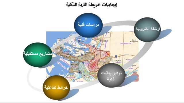
The Acting Executive Director of the Urban Planning Sector in the Abu Dhabi City Municipality, Eng. Khaled Nasser Al Menhali, stated that the importance of this project comes from its role in clarifying the nature of the soil in the Emirate of Abu Dhabi and other characteristics that require careful study, and determining its locations in a smart way to be taken into account during the design, And before construction for all buildings and infrastructure projects in the emirate. This database also shows the number of lands for which permits have been issued, and cases of daily transactions without reference to other systems, through a single smart step that enables the presentation of the required information to the user.
In turn, the Acting Director of Building Permits Department in the Abu Dhabi City Municipality confirmed that the smart soil map project for the various regions of the Emirate of Abu Dhabi aims to serve the community and in order to facilitate internal procedures on the relevant category used by engineers and data analysts, and to establish a continuous history of what has been achieved in soil improvements over the course of Years, where it was reported that icons - commands for searching, viewing, zooming, and converting from a paper report to a digital report were created to facilitate the use of this map for non-specialists, and to facilitate the presentation of the content, and a set of main layers and sub layers was placed inside it so that it could The user can view the required layer for the search target that he will do easily.