
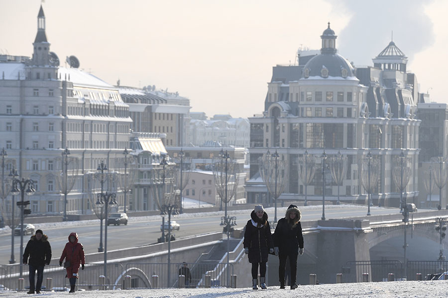
Severe frosts are expected in the Moscow region in the coming days.
The scientific director of the Hydrometeorological Center, Roman Vilfand, in an interview with RT, emphasized that "a very strong, extreme cold snap" is predicted.
He explained that a well-defined powerful anticyclone is moving to the European part of Russia.
“On the eastern periphery of this cyclone, not just cold, but subpolar air masses arrive.
Plus, the anticyclone will be slightly cloudy.
This means that at night, in the absence of clouds, there will be cooling, and during the day the temperature will rise.
And the range between night and day temperatures will be 12-15 degrees, ”Vilfand said.
According to him, on the night of Wednesday, March 10, -21 ...- 23 ° C is expected in Moscow, and up to -25 ° C in the region.
On Wednesday afternoon, a temperature of -11 ...- 13 ° C is predicted, this figure is 11-14 degrees below the climatic norm.
He added that similar values should remain on Thursday, March 11.
On Friday night, Vilfand said, it will “get warmer” to -15 ...- 20 ° C.
“It's still 8-9 degrees below normal.
But in the afternoon, in the second half, changes will begin.
Is a well-defined cyclone approaching the western borders of Russia?
and already in the afternoon on Friday and on Saturday night the center of European Russia will be on the periphery of this cyclone.
Which means that air masses will come from the south ... The temperature will start to rise, ”said the scientific director of the Hydrometeorological Center.
According to Tatiana Pozdnyakova, chief specialist of the Moscow Meteorological Bureau, it can get colder down to -25 ° C.
The forecaster is also of the opinion that the coldest days to come will be March 10 and 11.
“In Moscow it will be about -20 ° С, in the region up to -25 ° С.
In the Moscow region, the temperature will be below normal by about 12 degrees.
In the Yaroslavl, Tver and Kostroma regions, frosts can be much steeper, and there anomalies can reach 15 degrees, "Pozdnyakova said in an interview with RT.
RIA News
© Vladimir Astapkovich
At the same time, the meteorologist is confident that by the weekend the daytime temperature will be positive.
“We can say that the wave of the coldest weather will not stay here for long,” Pozdnyakova concluded.
Anatoly Tsygankov, deputy head of the situation center of Roshydromet, in an interview with RT, suggested that the temperature in the Moscow region could drop to -28 ° C.
“On the night of March 10 - partly cloudy, no precipitation.
The temperature will be -21 ... -23 ° C, in the region - in some places up to -25 ° C ... In the afternoon tomorrow - -11 ... -13 ° C.
On Thursday, March 11, at night - -19 ... -21 ° C, in the region - up to -24 ° C and in low places - up to -28 ° C.
During the day - -6 ... -8 ° C, in the region - up to -10 ° C ”, - said the forecaster.
According to him, Moscow found itself in the rear of the cyclone, against this background the atmospheric pressure increased.
The maximum values are expected on March 11 - 760 mm Hg.
Art.
“Then the next cyclone will begin to slowly enter the Moscow region, so on Friday, March 12, the weather will change,” Tsygankov said.
He added that the night of Friday, March 12, will still be cold, the temperature will be -16 ... -18 ° C.
“In the afternoon, the influence of the front will already begin.
Cloudy weather, light snow will begin, the wind will be south, gusty, up to 15 m / s.
Weekends: Saturday, Sunday - cloudy weather.
On Saturday - snow, at night - -7 ... -12 ° C, during the day - 0 ... -5 ° C.
On Sunday - even warmer ... At night - -2 ... -7 ° C, in the afternoon - -1 ... + 4 ° C.
And on Monday, March 15, - even warmer: partly cloudy, light rain, at night - 0 ... + 5 ° C, the temperature is already above zero, and in the daytime - + 4 ... + 9 ° C ", - explained the forecaster.
He concluded that truly spring weather can be expected from March 15, when the above zero temperature should be observed both during the day and at night.
Among other things, forecasters, against the background of current forecasts, warn of the likelihood of the formation of ice needles in the sky over Moscow.
Yevgeny Tishkovets, leading specialist of the Phobos weather center, told about this.
According to him, in the conditions of low-cloud anticyclonic weather, favorable for intensive radiation cooling of the air, the process of freezing of water vapor will take place.
"According to forecasts, in the period from 21:00 on March 10 to 03:00 on March 11, when the thermometers drop below minus 20, ice needles may appear in the Moscow sky," RIA Novosti quotes Tishkovets.
The forecaster also said that during this period frosty fog with a deterioration in visibility up to 500-1000 meters is not excluded.