
China News Service, December 29, according to comprehensive news, the Central Meteorological Observatory continued to issue a cold wave orange warning at 6 o'clock on the 29th: Affected by strong cold air, there will be strong winds and strong cooling in most of the central and eastern parts of my country.
It is expected that the temperature in most of the central and eastern regions will drop by 8-10°C from 8:00 on the 29th to 8:00 on the 31st, and the temperature in the southeast of the northeast, Huanghuai, Jianghuai, Jiangnan, and northern southern China will drop by 12 to 16°C, with local temperature drops. It can reach above 16℃.
There will be northerly winds of magnitude 4 to 6 and gusts of magnitude 7 to 9 in the above areas, and northerly winds of magnitude 7 to 9 and gusts of 10 to 11 in the eastern and southern sea areas of my country. After the temperature drops, the 0℃ line of the minimum temperature will be south to In the northern part of South China, the -10℃ line of the lowest temperature is from southern Huanghuai to Qinling.
Data map: Citizens wear thick coats to protect against cold weather.
Photo by China News Agency reporter Gao Zhan
The maximum temperature in most parts of the north has dropped to a low point, and many places have fallen below 0°C for the first time this winter
It is expected that today and tomorrow (December 29-30), as the main body of the cold wave rapidly expands southward, the maximum temperature in most parts of northern my country will drop to a low point, and many places may drop below 0°C for the first time this winter. 16°C.
In addition, today is still a concentrated period of large-scale rain and snow in the central and eastern regions. There will be heavy snow in Shandong, Jiangsu and other places, reminding the public to pay attention to the adverse effects of severe weather and road snow and icing on traffic travel.
The New Year’s Eve "Overlord" cold wave has been "delivered". Monitoring shows that at 7 o'clock today, compared with 7 o'clock yesterday, the temperature in western Gansu, northern Ningxia, northern Shaanxi, central and western Inner Mongolia, northwestern Shanxi, northwest and central Hebei, and Beijing has cooled down 6~10℃, and some areas in central Inner Mongolia dropped by 15~19℃.
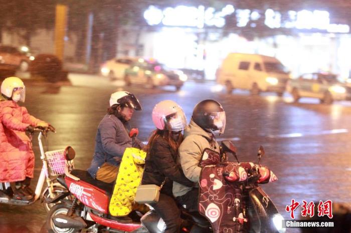
Many places in the central and eastern regions may change from rain to snow
Affected by the cold wave, since yesterday, many parts of the central and eastern regions have been "invaded" by rain and snow.
Monitoring shows that from 8 am yesterday to 6 am today, 6 to 8 gusts and local gusts of 9 to 10 occurred in eastern Northwest China, North China, Huanghuai, Jianghan and other places; rainfall, snow or other places appeared in Shandong, central and eastern Henan, etc. The sleet is 2-9 mm, and the local area of central Henan is 10-14 mm.
At 7 o'clock today, the depth of snow in central Shandong is 3-8 cm.
It is expected that the daytime will continue to be a period of concentrated rain and snow in the central and eastern regions. The intensity of rain and snow in parts of Shandong Peninsula, southern Henan, central and southern Anhui, and northern Jiangsu will be relatively high, and some areas will also experience the process of rain and snow conversion.
According to the Central Meteorological Observatory’s forecast, today, there are light to moderate snow or sleet in parts of the southeast of Northwest China, central Shaanxi, Huanghuai, Jianghuai, Jianghan, northern Jiangnan, central and eastern Chongqing, and northern Guizhou. Among them, Shandong Peninsula, There were heavy snowfalls in southern Henan, central and southern Anhui, and northern Jiangsu.
There was light to moderate rain in most parts of Jiangnan, the eastern and southern parts of Southwest China, and most of southern China.
Data map: Citizens travel in the snow.
Photo by Meng Delong
Three early warnings of the lowest temperature in Beijing or the extreme lowest temperature in December in the past ten years take effect
Today (29th), due to the cold wave, Beijing will have strong winds to cool down. At present, the three major warning signals of cold wave, continuous low temperature and strong wind are on the rise. The lowest temperature has dropped to -13℃, or close to the extreme lowest temperature record in December in the past 10 years. , Gusts can reach level 7, the lowest somatosensory temperature will be close to -20℃, the wind chill effect is significant, and public travel needs to be protected from cold and wind.
The Beijing Meteorological Observatory predicts that under the influence of cold wave weather today and tomorrow, there will be strong winds and sustained low temperatures in Beijing. At present, the blue warning signal of cold waves, sustained low temperatures and strong winds is high.
Among them, during the daytime in Beijing, from sunny to cloudy, the highest temperature will be only -6°C, and the lowest temperature will drop to -13°C. The lowest temperature is close to the extreme lowest temperature recorded in December in Beijing (-14.4°C) in the past 10 years.
In addition, today, Beijing gusts can reach level 7 during the day, and strong north wind gusts can reach level 6 at night. The wind chill effect is obvious, and the lowest body temperature may be close to -20℃.
The cold wave forward arrived in Guangdong this afternoon, and the minimum temperature in northern Guangdong dropped to 1 to 6℃
According to forecasts, this afternoon, the cold wave forward will arrive in northern Guangdong, and the process of drastic cooling in Guangdong will begin.
It is expected that under the influence of the cold wave front, light rain (snow) in the northern cities and counties of northern Guangdong will turn cloudy, and the other cities and counties will turn cloudy with sporadic light rain.
The temperature in various places has dropped significantly. The minimum temperature in northern Guangdong will drop to 1℃~6℃, and the lowest temperature will drop to 7℃~10℃ in central and southern cities and counties.
As for the city, Guangzhou today is cloudy during the day; cloudy at night; the temperature is between 9℃~25℃; the relative humidity is between 50%~65%; the slight easterly wind turns to the fresher northerly wind.
Data map: Citizens travel in the snow.
Photo by China News Agency reporter Zhang Chang
Zhejiang's strong wind, rain, snow and freezing all bring the temperature down to 12 to 14℃
Starting at noon today, the current cold wave weather will affect Zhejiang from north to south, and severe temperatures, strong winds, rain and snow, and severe freezing weather will continue to be encountered everywhere.
It is estimated that the daily average temperature in most parts of Zhejiang will drop by 12~14℃ today and tomorrow. It is very important to keep cold and warm!
According to forecasts, the strong cold wave will affect Zhejiang from north to south starting at noon today. Zhejiang will experience severe temperature drops, strong winds, rain, snow and severe freezing.
From 29 to 31, the average daily temperature in most parts of the province dropped by 12~14℃. From 1231 to the morning of January 1, 2021, the lowest temperature in most parts of the province was -4~-7℃. 8~-11℃, severe freezing.
Data map: Citizens travel in full "cover".
Photo by China News Agency reporter Yu Haiyang
Shandong's wind, rain and snow are still "online"
Affected by the cold wave weather, it is expected that Shandong will still be a day of “online” rain, snow, strong wind, and cooling. In some areas, there will be moderate to heavy snow, and local or blizzard; the wind force in the peninsula and other places will remain unchanged. Ground gusts can still reach level 7 to 8; in response, Shandong Meteorological Observatory continues to issue warning signals of cold wave yellow, blizzard yellow and road icing orange, and the public needs to take good care of cold and warm work.
According to forecasts, affected by the continued cold wave weather, Shandong is still a day of "online" strong winds and rain and snow.
Today, it is expected that the weather in northwestern Shandong will turn from overcast to cloudy, the weather in central and southwestern Shandong will turn overcast with light snow to cloudy, and the weather in other areas will be overcast with moderate to heavy snow and local blizzards.
There are northerly winds across the province, with magnitudes 5 to 6 and gusts ranging from magnitude 7 to 8 in the peninsula; gusts of magnitude 4 to 5 in other areas weakened to magnitude 3 to 4.
The lowest night temperature: about -14℃ in northwestern Shandong, central Shandong and eastern areas of southeast Shandong, below -16℃ in some parts, around -8℃ in coastal areas of the peninsula, and around -10℃ in other areas.
Gusts in some sea areas such as the Yellow Sea and the East China Sea can reach level 10 to 11
The Central Meteorological Observatory continued to issue a yellow warning for sea gale at 06:00 on December 29: It is estimated that due to strong cold air, from day to night on the 29th, the Bohai Sea, the Bohai Strait, most of the Yellow Sea, most of the East China Sea, the Taiwan Strait, and the east of Taiwan There will be strong winds of magnitude 8 and gusts of magnitude 9 to 10 in parts of the sea, Bashi Strait, Beibu Gulf, northeastern and northwestern parts of the South China Sea, including the southwestern part of the Yellow Sea, the western part of the East China Sea, the Taiwan Strait, and parts of the sea east of Taiwan. The wind can reach level 9 and gusts can reach level 10 to 11.