
Original title: In addition to mobile navigation, what other innovative applications of Beidou
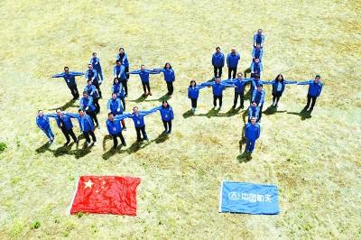
Aerospace Science and Technology "Beidou" team was selected as the "Most Beautiful Struggler": The picture shows some members of the team posing with the word "Beidou".
Xinhua News Agency
Xinhua News Agency
From navigating on the map, to ordering food for takeout, to parking in the garage, the Beidou satellite navigation system is now ubiquitous in the lives of ordinary people. Currently, there are more than 372 million mobile phones using Beidou navigation system worldwide. What few people know is that helping to prevent and control the epidemic is a new bright spot in the Beidou application this year. The Beidou system has played an extremely special role in the "Wuhan Defense War" of epidemic prevention and control: from the construction and application of Huoshenshan and Leishenshan hospitals to the transformation of shelter hospitals, from the deployment of medical supplies to the guaranteed supply of daily necessities, from From the epidemiological investigation of the virus to the application of the Wuhan Health Code, Beidou has been found. On the eve of National Day, the China Beidou Application Conference was held in Wuhan, Hubei. Academicians Li Deren, Liu Jingnan, and Tan Shusen shared many innovative applications of Beidou.
Academician Li Deren of Chinese Academy of Sciences and Chinese Academy of Engineering: Beidou system accurately assists epidemic prevention and control
The concept of PTN includes positioning, navigation, and timing services.
Generally, it refers to a unified time-space reference network and different communication networks, which can be independent or combined with mobile terminals to provide various users with real-time dynamic and comprehensive information services of spatial location and timing, also known as navigation location services.
The third-generation Beidou system is to provide global PTN application services. The feature is that the information has been expanded from 120 Chinese characters to 1,000 Chinese characters, achieving high-precision positioning above the centimeter level.
This year, the Beidou system has accurately assisted the epidemic prevention and control in Hubei. For example, the location of Huoshenshan and Leishenshan hospitals, the deployment of hospital materials and daily necessities, including drones to deliver things, and hospitals’ robots for delivering medicine, all use Beidou. system.
Common people also use Beidou navigation and positioning when parking. The integrated positioning is realized on the mobile phone through the satellite positioning of the equipment, indoor sensors and signal positioning.
During the epidemic, Wuhan also applied the Beidou system and traffic big data to establish a smart city transportation system in Wuhan, which effectively managed 3.5 million to 4.5 million vehicles and more than 60,000 roads.
This year, we also made an epidemic tracking software using Beidou technology to automatically generate health codes on mobile phones.
It can be said that Beidou supported the people of Hubei in successfully fighting the new crown virus epidemic.
PNT's services are still inadequate. For example, the content of the service is a point location, a line is navigation, and timing is also a time point. It does not cover various elements of the surface. There is no way to provide target information and surface information represented by images and videos. Real-time navigation enhancement, precise timing, rapid remote sensing, and integrated mobile broadband communication services between the world and the earth are needed.
In the future, we have to solve eight core technical problems, such as intelligent earth observation technology, new earth navigation and positioning methods, establishment and maintenance of earth time and space reference, aerospace environment, satellite resource organization and scheduling, network communication and security, smart satellites Platform and load, etc.
Currently, a Beidou application software is being developed, which brings together 12 types of positioning information and provides services on the mobile App.
This system can be applied to the hospital to realize the tracking, processing and automation of the patient’s equipment. When this system is applied to the mobile phone, the mobile phone becomes an intelligent assistant. If an elderly person falls outside, the mobile phone can tell the doctor when Wherever it falls, it can also be applied to the Internet of Things to locate the charging pile to ensure the safety of charging new energy vehicles.
It can also do high-precision navigation and positioning maps to realize intelligent driving.
Beidou can solve the problem of intelligent road testing system.
When a car is driving on the road, the signs on the road are for people to see, so using Beidou to build a road-measuring system is the key to achieving intelligent driving.
From the perspective of current demand, from PNT to PNTRC, China cannot wait for the development of my country's independent communication, navigation and remote integration space-based information real-time intelligent service system, and it must seize the time to do a good job in basic research and application.
In the future, the needs of PNT will move towards real-time and instant, from static to dynamic and high-speed, from rough to precise and complete, from outdoor to indoor, from land to ocean and sky, from region to wide area and global.
The Beidou application will also integrate mobile Internet and intelligent manufacturing, and will penetrate into various fields of the economy and into the lives of ordinary people.
Academician Liu Jingnan of Chinese Academy of Engineering: Beidou can realize global two-way communication
Positioning and timing are the concepts of absolute position related to space and time, respectively, and navigation is the concept of relative space-time measurement in two positions of space and time.
Beidou system is the only satellite navigation system in the world that realizes the integration of communication, navigation and remote.
The performance advantage of the Beidou system is that it has many functions, and the global short message communication can be used for search and rescue.
Navigation and positioning + global two-way communication can quickly announce rescue arrangements to callers.
There are also remote sensing applications, active remote sensing, equipped with spaceborne remote sensing of space environment and ionospheric remote sensing load; passive remote sensing, electromagnetic waves through the atmosphere, ocean, land reflection or diffuse reflection to remotely sense atmospheric water vapor, ocean rivers and lakes.
Beidou is the only satellite navigation system in the world that has announced a standard location service accuracy better than 5 meters.
All three types of Beidou 3 different-orbit satellites have realized inter-satellite ranging and data transmission. Ka-band links are used, with high ranging accuracy and communication frequency bandwidth, which are far better than UHF links. The next generation will use laser links. Road, the distance measurement is more accurate.
At present, the Beidou 3 inter-satellite link has been fully activated, and the effect is remarkable. It has the highest accuracy in GNSS, ensuring the high accuracy of standard PNT services.
The Beidou system's medium orbit satellites have 2 on each of the three orbital planes to ensure that distressers can be received in the global domain to upload UHF band distress signals, and then download them to the International Search and Rescue Center. 24 medium orbit satellites can receive the search and rescue signals from the International Search and Rescue Center. Notify the helper, and at the same time can send relevant rescue short messages to the helper.
In terms of innovative design, because the frequency bands of Beidou are abundant, there are now five frequency bands for Beidou 2 and Beidou 3.
Then there is the design of compatible and interoperable signals, innovative modulation technology, the signal quality is internationally leading, and it can receive the same function as GPS.
In general, these developments are conducive to improving the accuracy of Beidou 3's PNT.
According to the advantages of Beidou, how to use it to develop applications?
It is necessary to integrate communication, navigation and remote control, make full use of Beidou's multi-band navigation signal advantages to carry out multi-purpose or dedicated high-performance low-cost PNT research and development, improve PNT service capabilities, make full use of inter-satellite link ranging, and study or separate different tracks and models The satellite system makes full use of the two-way service capabilities of short messages around the world and China to expand the service content, develops patents for image transmission, voice transmission, and video transmission, and makes use of two-way communication and PNT integration service functions, and uses the integration of communication, navigation and remote to develop Multi-task and multi-target collaborative intelligent dispatch emergency application, fully utilize the L-band and S-band carriers of Beidou GNSS satellites as remote sensing radiation sources to develop new types of remote sensing, especially target remote sensing.
Beidou RDSS two-way link positioning timing can greatly improve the anti-jamming and anti-spoofing performance of Beidou positioning timing. The two-dimensional positioning accuracy of RDSS has reached about 10 meters. The time comparison accuracy can be doubled compared with the one-way passive receiving method. , To about 10 nanoseconds, for some users who do not require too much time comparison frequency and require high absolute time accuracy, such as finance, communications, blockchain platforms, emergency rescue command center operation control platforms, etc., there is the most demand. This type of absolute timing service with high anti-interference requirements can be expanded.
Using the RDSS two-way communication function, it is possible to develop a shared multi-departmental coordinated dispatch system, such as an integrated intelligent operation control platform.
Beidou 3's innovative design, service capabilities, precision advantages, and stable operation constitute a strong late-comer advantage and development potential. It is accepted by countries and regions along the "Belt and Road". It is worthy of "China's Beidou, the world's Beidou, and the first-class Beidou" The reputation of “Beidou Navigation, Sharing the World”.
As a space-time technology, the Beidou system is not only the perception and cognition of the earth's resource environment and its dynamic change information, but also the core foundation for realizing accurate space-time and deployment management of the perceived objects.
The first focus of Beidou's development and application is to give other technologies, such as information, network, energy, resources, environment, transportation and other technologies, the perception of precise time and space location, so that they can be upgraded to the stage of intelligent management and control, while achieving management Time and space intelligence of the control process.
Another focus of Beidou application is to comprehensively develop its advantages in communication, navigation, and remote integration, and to play its role in spatial intelligence across technologies, fields, and even across time and space. The future goal is to study PNT natural intelligence and develop smart PNT technology. To develop new applications.
Academician Tan Shusen of the Chinese Academy of Engineering: China’s 5G will succeed, and 6G will definitely succeed
What is a spatial benchmark?
The space datum is used to determine the orbital parameters. The connected coordinate origin and the earth rotation parameters jointly construct the GNSS system space datum. The Chinese Beidou space datum and the Chinese geodetic coordinate system are the same coordinate frame.
I think there are only two practical benchmarks in the world, one is GPS time-space benchmark, and the other is Beidou time-space benchmark.
The time-space benchmark is the basic condition for the Internet to be upgraded to the Internet of Things. Without a unified time-space benchmark, it is difficult to imagine how things are connected.
The development of Beidou system is a process of continuous innovation and pioneering spirit.
The main achievement of Beidou-1 is that two satellites realize large-scale high-precision positioning and timing services. It covers China and surrounding areas. According to the principle of GPS positioning, 12 satellites are required, and the two-way timing accuracy is 10ns, leading the world.
The positioning and message communication are completed within one second, becoming the highlight of international voyage tracking and life rescue. Positioning and reporting are completed on the same channel at the same time. The user knows where I am and the command department knows where we are. The positioning report is the biggest difference between Beidou and GPS. Features.
Beidou is the world's first navigation system with complete three-frequency service capabilities. In 2012, the three-frequency navigation and positioning of B1, B2, and B3 will be broadcast in a full constellation. When GPS will complete the three-frequency navigation, it is still not easy to predict.
It was said that it will be completed in 2020, but it is not yet seen in which year it can be completed.
Beidou is the world's first dual-mode fusion system for continuous navigation and positioning reporting. The dual-mode user machine has exerted tremendous social and economic benefits.
The main achievement of Beidou-3 is to independently build a global time-space reference. Why is it said that only Beidou-3 can be regarded as the time-space reference that China provides to the world for satellite navigation?
Because only the global system has a representative description of the global system, those regional systems do not have the ability to build time and space benchmarks, so the Beidou-3 system actually completed the navigation from the first stage to the fourth stage, so Beidou The achievements are cross-generational.
Beidou-3 has six major functions, including basic navigation as the foundation, integrating SBAS, PPP, MSS, etc., with enhanced accuracy, integrity, and information that will better serve all types of users.
Beidou MMS is short message communication, using the RDSS method.
The inter-satellite link of Beidou is actually the sharing of the global mobile communication system in China. It is not only the two-way data link of global mobile communication, but also the system of China's space-time inter-satellite clock difference. It can also be further expanded to a time-space reference maintenance system.
China's Beidou has been built, basically at the L frequency meter level navigation accuracy level.
In 2030 or 2035, an aerospace system with deep integration of navigation, communication and remote sensing will come from China. China's high-speed space network plus 5G ground network will realize the global interconnection of objects and objects in the sky, that is, the sixth generation of mobile communications, 6G China’s path is different from that of Western countries. China first builds a ground system and then a space system. China’s space system is built on the Beidou time-space benchmark, so China’s 5G will succeed, and China’s 6G will also succeed. It will succeed.
In the future Beidou new navigation system, in the LEO orbit, the implementation of the deep integration of navigation and communication, and the service of remote sensing policy, to achieve the goal of the global Internet of things and digital earth.
In the future, there will be the Beidou Global Internet of Things.
The Internet is a connection between people, and people are very inclusive. To realize the interconnection of global dynamic things and things, the global Internet of things can only be realized under the maintenance of time and space benchmarks.
The world-class satellite navigation system at the static centimeter level and dynamic decimeter level has been implemented in the Beidou-3 system. It provides a space-based Internet of Things with a unified time and space reference, and a space-based radio global system that gains knowledge of the earth. In the future, Beidou space-based objects The networking module will realize the interconnection of space objects and space objects, and the networking of space objects and earth objects. The task goes beyond the research of earth navigation methods.
Its meaning is to give full play to the fundamental value of the Beidou time-space benchmark, break the solidification of the world's navigation, communications, and remote sensing independent construction industries, and provide a public data link for most industries, including remote sensing.
In short, the Beidou multi-service satellite radio system is an important national space information infrastructure. The integration and innovation of Beidou-3 in basic navigation, satellite-based enhancement, precision single-point positioning, message communication, international search and rescue and other services are good for future development. beginning.
The Beidou time-space reference link and high-speed digital link are well constructed and will become the "intelligent highway" of my country's aerospace system.
■Related Links
Beidou application in life
Now, map query, mobile navigation, ride-hailing services, shared bicycles, express delivery, etc. often use the Beidou satellite positioning function in mobile phones.
In the future, the combination of 5G, artificial intelligence and the development of wearable devices will greatly expand Beidou's popular applications and realize integrated indoor and outdoor positioning and navigation, including the realization of remote medical monitoring, smart travel services, smart travel services, personal safety assurance and emergency rescue Wait.
In 2019, the overall output value of my country's satellite navigation and location service industry with the development of Beidou application as the core reached 345 billion yuan. Compared with the time when Beidou just provided services in 2012, the overall output value has increased by four times. The development continues to deepen, and the associated output value driven by the epidemic is as high as 228.4 billion yuan, showing that the ecology of my country's Beidou application and industrialization development has been initially formed.
In addition, in recent years, Beidou's innovative applications have been deeply integrated into the transformation and upgrading of many industries. Key enterprises in the fields of automobiles, high-speed rail, energy, mining, post, mobile communications, transportation and logistics, Internet services, etc. are actively "+ Beidou" Development has become a new force in the industry, which has greatly promoted the overall development of my country's satellite navigation and location service industry, and the contribution of the industry's economic benefits has been significantly improved.
Beidou's overseas application cooperation and trade exchanges have also become more frequent. Land right confirmation, precision agriculture, smart construction, and smart ports based on Beidou have been successfully applied in ASEAN, South Asia, Eastern Europe, West Asia, Africa and other places.
In the future, the development and promotion of national strategies such as new infrastructure and the “Belt and Road”, Beidou technology applications and space-time services will become more popular, and will be integrated with 5G, Internet of Things, big data, etc., will more profoundly change people’s lives and show Broader application prospects.