China News Agency, Beijing, August 3 (Reporter Ruan Yulin) Typhoon "Hagupit" has struck strongly and has caused squally winds and waves in the southern waters of the East China Sea. As it coincides with the astronomical high tide period, the typhoon affects the coastal waters with higher astronomical tides and severe sea conditions. The National Ocean Forecasting Station issued double orange warnings for storm surge and waves on the 3rd.
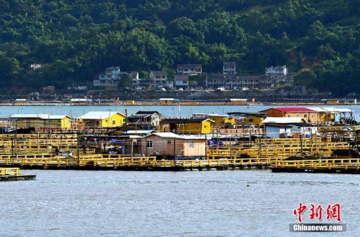
Data map: On August 3, fishermen from Shacheng Port, Fuding City, Fujian Province came ashore to take shelter before the typhoon. Photo by Zhang Bin
This year’s No. 4 typhoon "Hagupit" has been strengthened from a severe tropical storm to a typhoon at 2 o'clock in the afternoon on the 3rd. At 5 o'clock in the afternoon, its center is located on the southern part of the East China Sea about 225 kilometers southeast of Wenzhou City, Zhejiang Province. It is expected that "Hagupit" will move to the northwest at a speed of 20 to 25 kilometers per hour, and will land on the coast from Wenling to Cangnan in the early morning of the 4th.
The facts show that the southern waters of the East China Sea where the typhoon center passes have set off huge waves of 4 to 6 meters, and the coastal waters of Zhejiang have seen large waves of more than 3 meters, and the sea conditions have gradually deteriorated.
Affected by the forecast from the National Ocean Forecasting Station, it is expected that from August 3rd to 4th, there will be 30 to 70 cm increase in storm water from Hangzhou Bay to Ningbo, Zhejiang, and 70 to 200 cm increase in storm water from Zhejiang Taizhou and Wenzhou coasts. Water, the coastal areas of Ningde, Fujian and Fuzhou will see 30-50 centimeters of storm surge.
Experts pointed out that due to the astronomical high tide period, the typhoon affected the coastal waters with higher astronomical tides, and the intensity of typhoon Hagupit would increase before it landed. The adverse effects of the sea conditions should not be underestimated.
It is expected that from the night of August 3rd to noon on the 4th, there will be 5 to 8 meters of huge waves in the southern part of the East China Sea, the waters near the Diaoyu Islands, and east of Taiwan to the violent waves, and the Taiwan Strait will have 3 to 4.5 meters of waves to the violent waves. ; There will be large waves of 3.5 to 5 meters in coastal waters of Zhejiang, and large waves of 2.5 to 3.5 meters in coastal waters of northern Fujian.
The National Ocean Forecasting Station reminded that ships operating in the affected seas should pay attention to safety, and coastal governments and relevant departments should pay close attention to changes in coastal tide levels and make emergency preparations for storm surges. (Finish)

