
During the first 20 days of April, the temperature in the metropolitan area was in line with the norm, Tatyana Pozdnyakova, chief specialist of the Moscow Meteoburo, told RT. In the remaining days of the month, according to her, the indicators will not change much.
On April 21, during the day, according to the forecast of the Hydrometeorological Center, the air temperature warms up to +9 ... + 11 ° C. The weather will be cloudy with clearings, mostly without precipitation.
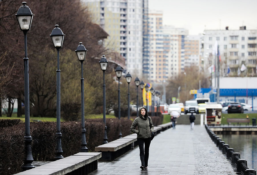
According to the forecast of the Moscow Meteoburo, the temperature at night in the capital will be about 0 ° C, in the city center it can reach low positive values. On Wednesday and Thursday, April 22 and 23, during the day the thermometers will show about +6 ... + 7 ° С.
“The fact is that during April our norm grows very quickly, and therefore the second decade will definitely be below the climatic norm,” Pozdnyakova explained.
At the same time, if at the beginning of the week the anticyclone will still determine the weather, then closer to the middle of the week it will be replaced by a cyclone, the chief specialist of the Moscow Meteuro Bureau noted.
“In the coming days, the influence of the cyclone that circles over the Urals will intensify and the weather will be less comfortable: a gusty north wind will appear, gusts can reach 15-20 m / s,” the meteorologist said.
"Negative anomaly"
The scientific director of the Hydrometeorological Center of Russia, Roman Vilfand, for his part, noted that on Tuesday, April 21, the temperature will be closest to the April norm, "well, or differ from the norm by 1-2 ° C with a minus sign."
“The anomaly will still be negative. This is due to the fact that now Moscow and adjacent areas are in the so-called convergence zone - the convergence of the flows of two pressure formations. An anticyclone will go to the west of Moscow, a cyclone to the east, the zone of convergence of the northern flows between them, therefore, advection of cold air takes place, it causes such a low temperature, ”said Wilfand RT.
The anomaly will be most pronounced in the south of European Russia. As the scientific director of the Hydrometeorological Center of Russia said in an interview with RIA Novosti, in the Rostov region and in the Krasnodar Territory, the indicators will be below the norm by 4.5 ° С.
- AGN "Moscow"
- © Sofya Sandurskaya
In the metropolitan region, despite the cool weather, drivers can already safely change winter tires to summer tires. As Wilfand explained in an interview with TASS, the Hydrometeorological Center no longer predicts "such strong ice on the roads and prolonged icy conditions."
Along with this, the site of the Hydrometeorological Center of Russia noted that the current month "did not indulge the inhabitants of the European part of Russia with stable warm and dry weather."
When to expect warming?
By the weekend in Moscow and the region a little warmer. According to the estimates of the Hydrometeorological Center, on Saturday, April 25, the air warms up to +7 ... + 12 ° С, on Sunday the columns of the thermometers will show +9 ... + 14 ° С. But it’s impossible to say that spring weekend will bring warmth to the capital, Villefand notes.
“In the temperate latitudes of Eurasia and the European part of Russia, there is no day from which spring and warm weather will come from now on. In principle, spring weather is variable, variable, ”the meteorologist explained.
According to him, in the tropics or subtropics, indeed, there is a certain starting point, after which we can talk about the beginning of a new season, for example, about the advent of the monsoon period.
“This does not happen in temperate latitudes, therefore, of course, there will be warming and cooling. May frosts are a very typical phenomenon, but in May the temperature can reach +25 ° С, ”the scientific director of the Hydrometeorological Center of Russia emphasized.
The third decade of April is characterized by a temperature of +15 ° C, but this month it will be lower, Villefand added. According to him, "this is normal, it often happens."
In the Asian part of Russia, the weather, on the contrary, is more like summer. According to the forecast of the Hydrometeorological Center, a powerful heat transfer is expected over the north of Western Siberia, and southern winds will blow. Hot air masses will come from China, Mongolia and Central Asia. Until the end of the week in the Novosibirsk, Kemerovo and Tomsk regions during the day, the thermometer columns will rise to +20 ... + 26 ° С. In the Omsk region and in the Altai Territory, the air can warm up to +28 ° С, in the south of the Krasnoyarsk Territory - up to +20 ... + 25 ° С.