
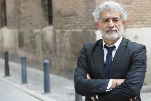
Also in climate change, a picture is worth a thousand words. This is what physicist José Antonio Sobrino (Outomuro, 1961), the researcher at the University of Valencia, who this week has received the King Jaime I Prize for Environmental Protection 2019 for his surveillance work on the planet using satellites that photograph the Earth From space.
This Galician scientist, a world reference in this field, adjusts the algorithms that make possible the use of data from the Earth Observation Satellites of the European Space Agency (ESA). His studies apply to the calculation of the temperature of the earth, the oceans, the vegetation cover, the transpiration of crops or the heat in the cities.
They have given him an award for Environmental Protection for his work in remote sensing, a somewhat unknown science. Did you expect it? I was surprised because it is not a discipline that you pay attention to. But due to climate change, collaboration with ESA and the new constellation of Sentinel satellites is receiving the attention it deserves. Seven have already been launched and by 2027 20 more will be launched. What data do you work with? I work with satellite data. Their advantage is that they give global coverage. For measuring the temperature we have images in which each pixel corresponds to one kilometer. At that spatial resolution, everyone can be swept away with daily images. Weather stations are only at certain points and may not always represent a large area. In the sea there are fewer stations than on the ground, due to the technical difficulties involved. Does remote sensing photograph climate change? It is the only tool that gives an image of the terrestrial globe at a time according to the parameter you want. ESA has satellite data since the 80's to study essential climatic variables: temperature, sea salinity, ocean color, sea level, fires, clouds, aerosols or soil moisture. The forcefulness of satellite images can be shown at the level of deforestation, desertification, pollution, temperature rise and thaw. It is surprising that there are still deniers. The satellites show clear images of climate change that are worth more than a thousand words. Do your data confirm climate change? Since 2003, when we use the data from the Modis sensor, we have seen how the temperature of the globe has increased by about two tenths every 10 years. This, in 100 years is two degrees. Since pre-industrial times we have already increased 1.1 grade. The Intergovernmental Panel on Climate Change Experts (the IPCC) published a report to try to keep us at 1.5. This will be very difficult, since they are measures that should be already being implemented or are very drastic to reduce carbon dioxide, which continues to rise. It is very possible that we exceed two degrees or even more. How does Spain appear in its data? In the Mediterranean, our data shows twice what happens globally. If we talk about two grades in 100 years, here are four in 100 years. We also see how the border that differentiates the arid zone from non-desert areas moves from the south to the north, going up a series of kilometers per year. That looks good in the pictures. In the case of the Iberian Peninsula, it is as if the desert entered through Gibraltar and Cádiz and gradually climbed. Each time the soils are drier, which is a breeding ground for forest fires. How do you prevent remote sensing of fires? In collaboration with Civil Protection we can give the points at which a fire has started. We have an image every 15 minutes. In a fire of a certain extent, you can see its evolution. We also develop a method to estimate the perimeter and the burned area and study the severity of fires. When vegetation is burned, the soil will suffer degradation. Our goal is to detect it and act before the rain drags the soil. Satellite images are also used in agriculture. Spain is one of the few countries in the world where agricultural drought insurance is calculated using remote sensing data. . The vegetation index of the Modis sensor is used and compensation is charged based on the drought it shows. We also have a project on evapotranspiration that suggests to the farmer the needs of irrigation during a period of eight to ten days, which allows to save water. Now drones are also used in remote sensing What advantages do they provide? They allow a very high precision. They can even detect a vine plantation where there is drip irrigation and see where water does not reach a plant. With a thermal band you can see the water stress. This cannot be done from satellite because we don't have so much spatial resolution, especially in Spain, where the plots are very fragmented. With a one-kilometer resolution sensor, such as Modis (on board Terra and Aqua satellites), at least three kilometers of side is needed to obtain a pure pixel and that is not normal in our country. The plots are usually smaller. What European missions could solve these shortcomings? Satellites of higher resolution, such as the American Landsat, are needed. In the thermal we only have low resolution satellites, like Meteosat. Sentinel 2, with resolutions of 20 meters, is the one that replaces Landsat at European level. This satellite does not have a thermal band and that is why Sentinel 8 is launched. One of my goals is to convince the European Space Agency to launch a thermal satellite. The future Sentinel 8, with a resolution of between 30-50 meters, would allow an accurate estimate of the water needs of the crops. It could be operational in 2025. It will also measure the temperature in cities and lakes, estimate the decrease in the Arctic ice sheet and deforestation in the Amazon.According to the criteria of The Trust Project
Know more- Science and Health
- science
- Climate Summit
- Environment
- Climate change
Madrid climate summit Trip to Tangier, the island of deniers that is devouring the sea
Climate crisis What can you do for your planet?
ScienceThe Climate Summit, live | Felipe VI: "There is still time. We cannot, we must not fail"