
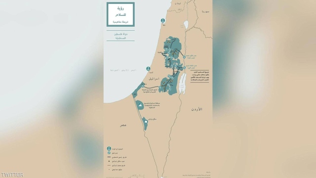
The White House released on Tuesday a map of the proposed borders for the future Israeli and Palestinian states as part of the controversial peace plan announced by US President Donald Trump to resolve the conflict between the two parties.
The map shows 15 Israeli settlements in the West Bank area connected to the Gaza Strip through a tunnel, in line with a promise by the US President to establish a Palestinian state connected to the territories.
Palestinian officials vehemently reject the US plan, announced by Trump at a joint press conference with Israeli Prime Minister Benjamin Netanyahu at the White House.